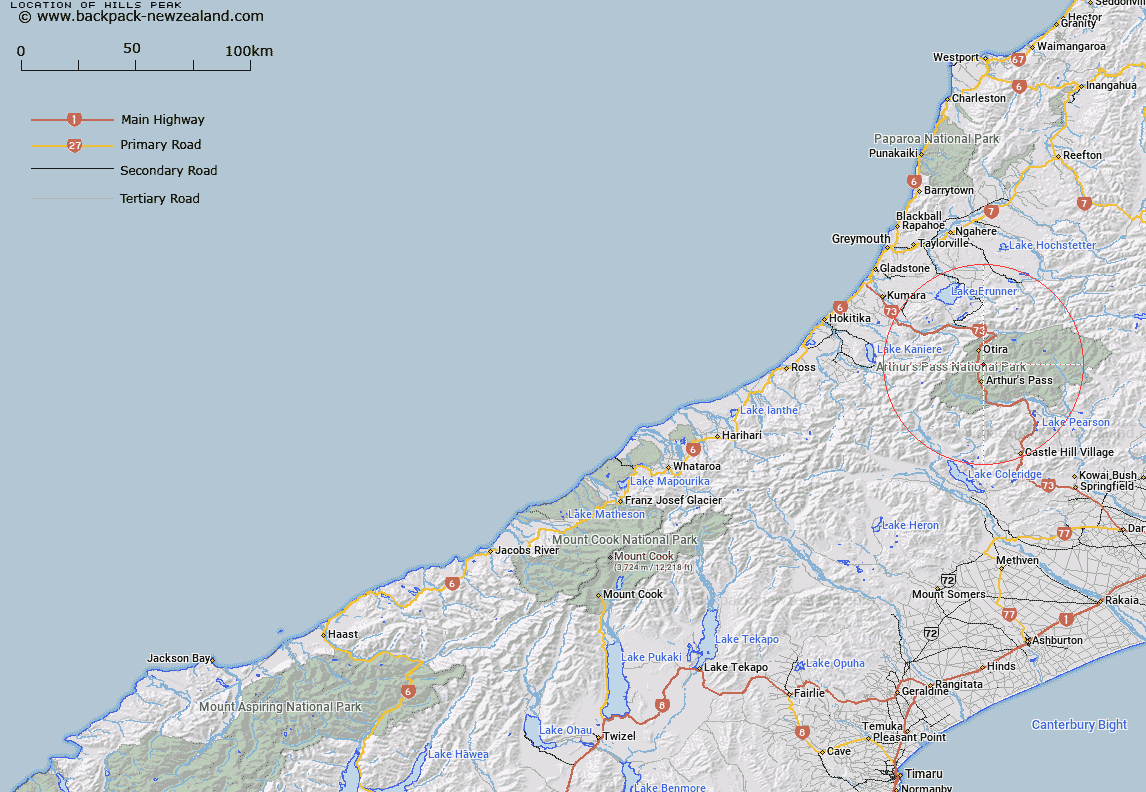
Map showing location of Hills Peak


LINZ description: Peak rises on a spur above the Zig Zag in the Otira Gorge.
Latitude: -42.880848
Longitude: 171.573259
Northing: 5251429.4
Easting: 1483483.3
Land District: Westland
Feat Type: Hill


Scroll down to see a more detailed road map and below that a topographical map showing the location of Hills Peak. The road map has been supplied by openstreetmap and the topographical map of Hills Peak has been supplied by Land Information New Zealand (LINZ).

Yes you can use the top static map for you school/university project or personal website with a link back. Contact me for any commercial use.

Hills Peak Map New Zealand


New Zealand places in our database
[ A ] [ B ] [ C ] [ D ] [ E ] [ F ] [ G ] [ H ] [ I ] [ J ] [ K ] [ L ] [ M ] [ N ] [ O ] [ P ] [ Q ] [ R ] [ S ] [ T ] [ U ] [ V ] [ W ] [ X ] [ Y ] [ Z ]


Closest 20 Hills to Hills Peak

Phipps Peak ( 2.22km )   Warnocks Knob ( 2.26km )   Mount Temple ( 2.7km )   Blimit ( 3.73km )   Mount Philistine ( 3.9km )   Mount Cassidy ( 4.04km )   Mount Aicken ( 5.98km )   Mount Rolleston ( 6.03km )   Goat Hill ( 6.03km )   Mount Barron ( 6.13km )   Mount Armstrong ( 6.67km )   Anderson Peak ( 6.76km )   Mount Oates ( 6.96km )   Mount Franklin ( 7.14km )   Mount Russel ( 7.4km )   Mount O'Malley ( 7.54km )   Avalanche Peak ( 7.56km )   Mount Lancelot ( 7.56km )   Lyell Peak ( 8.89km )   Carrington Peak ( 9.15km )   Mount Tarapuhi ( 9.19km )   Falling Mountain ( 9.52km )   Mount Bealey ( 9.8km )   Mount Williams ( 9.93km )   Mount Guinevere ( 10.16km )   Mount Scott ( 10.28km )   Mount Wilson ( 10.3km )   Mount Bowers ( 10.33km )   Kellys Hill ( 10.96km )   Mount Stewart ( 11.68km )   Mount Pfeifer ( 11.7km )   Taipos Breast ( 11.81km )   One Shot Hill ( 11.81km )   Mount Campbell ( 12.67km )   Dome ( 13.07km )   Mount Walcott ( 13.48km )   Mount Hunt ( 14.14km )   Mount Foweraker ( 14.4km )   Rangi Taipo ( 14.43km )   Rugged Peaks ( 14.68km )