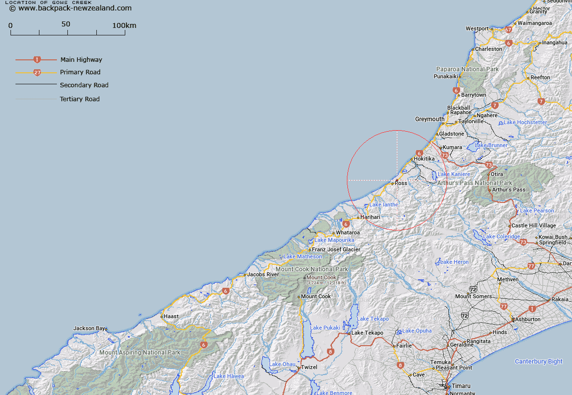
Map showing location of Gows Creek


LINZ description: Feature shown on: NZMS260 J33 Edition 1 1991 Reprinted 1994
Latitude: -42.871306
Longitude: 170.852944
Northing: 5251240.3
Easting: 1424629.1
Land District: Westland
Feat Type: Stream


Scroll down to see a more detailed road map and below that a topographical map showing the location of Gows Creek. The road map has been supplied by openstreetmap and the topographical map of Gows Creek has been supplied by Land Information New Zealand (LINZ).

Yes you can use the top static map for you school/university project or personal website with a link back. Contact me for any commercial use.
Gows Creek Map New Zealand


New Zealand places in our database
[ A ] [ B ] [ C ] [ D ] [ E ] [ F ] [ G ] [ H ] [ I ] [ J ] [ K ] [ L ] [ M ] [ N ] [ O ] [ P ] [ Q ] [ R ] [ S ] [ T ] [ U ] [ V ] [ W ] [ X ] [ Y ] [ Z ]


Closest 20 Streams to Gows Creek

Lander Creek ( 2.04km )   Stenhouse Creek ( 2.07km )   Bennett Creek ( 2.47km )   Woolhouse Creek ( 2.7km )   Hodson Creek ( 2.87km )   Camp Creek ( 3.25km )   Purvis Creek ( 3.31km )   Rocky Creek ( 4.01km )   Howe Creek ( 4.07km )   Harvey Creek ( 4.1km )   Curry Creek ( 4.41km )   Coal Creek ( 4.44km )   Haggart Creek ( 4.61km )   Fox Creek ( 5.04km )   Pringle Creek ( 5.32km )   Dobson Creek ( 5.4km )   Donnelly Creek ( 5.49km )   Ogilvie Creek ( 5.54km )   Jones Creek ( 5.58km )   Hatters Creek ( 5.64km )   Disce Creek ( 5.82km )   Robinson Creek ( 6.05km )   Cameron Creek ( 6.07km )   Totara River ( 6.15km )   Shooting Creek ( 6.17km )   Clear Creek ( 6.19km )   Ross Creek ( 6.34km )   Constitution Creek ( 6.42km )   Sweeney Creek ( 6.75km )   Bittern Creek ( 6.81km )   Scott Creek ( 6.94km )   Simpson Creek ( 6.99km )   Mirror Creek ( 7.1km )   Long Tunnel Creek ( 7.12km )   Calder Creek ( 7.38km )   Scandinavian Creek ( 7.39km )   Franklin Creek ( 7.41km )   Swindlers Creek ( 7.58km )   Redman Creek ( 7.61km )   Monteith Creek ( 7.68km )