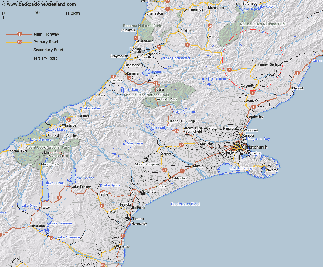
Map showing location of Ghost Gully


LINZ description: A branch of the Styx River at the eastern end of Hanmer Range
Latitude: -42.465137
Longitude: 172.793694
Northing: 5298557.5
Easting: 1583039.3
Land District: Canterbury
Feat Type: Valley


Scroll down to see a more detailed road map and below that a topographical map showing the location of Ghost Gully. The road map has been supplied by openstreetmap and the topographical map of Ghost Gully has been supplied by Land Information New Zealand (LINZ).

Yes you can use the top static map for you school/university project or personal website with a link back. Contact me for any commercial use.

Ghost Gully Map New Zealand


New Zealand places in our database
[ A ] [ B ] [ C ] [ D ] [ E ] [ F ] [ G ] [ H ] [ I ] [ J ] [ K ] [ L ] [ M ] [ N ] [ O ] [ P ] [ Q ] [ R ] [ S ] [ T ] [ U ] [ V ] [ W ] [ X ] [ Y ] [ Z ]


Closest 20 Valleys to Ghost Gully

Williams Valley ( 3.44km )   Peters Valley ( 6.62km )   Long Gully ( 9.7km )   Bush Gully ( 10.42km )   Leader Dale ( 11.15km )   Mitchells Cutting ( 11.18km )   Sawpit Gully ( 12.17km )   Mikes Gully ( 13.17km )   Gabriels Gully ( 14.73km )   Stanley Gates ( 15.16km )   The Narrows ( 17.09km )   Aniseed Valley ( 19.06km )   Straight Gully ( 20.37km )   Bushy Corner Gully ( 21.16km )   Magdalen Valley ( 23.12km )   Bullock Gully ( 29.78km )   Glacier Gully ( 30.16km )   Hughs Gully ( 30.45km )   Dynamite Gully ( 30.58km )   Camera Gully ( 31.23km )   Freezing Gully ( 31.32km )   Cannibal Gorge ( 33.7km )   Island Gully ( 34.34km )   Rag and Famish Gully ( 34.66km )   Dismal Valley ( 35.06km )   Deer Valley ( 35.09km )   Horse Gully ( 41.1km )   Travellers Valley ( 41.14km )   Wairau Gorge ( 46.03km )   Flapper Gully ( 46.53km )   The Sluice Box ( 48.7km )   Black Gate Gully ( 52.33km )   Big Bush Gully ( 53.88km )   Hurricane Gully ( 54.05km )   Old House Gully ( 54.81km )   Guide Gully ( 55.2km )   Boundary Gully ( 57km )   Whites Gully ( 58.87km )   Pig Gully ( 59.83km )   Middle Gully ( 59.84km )