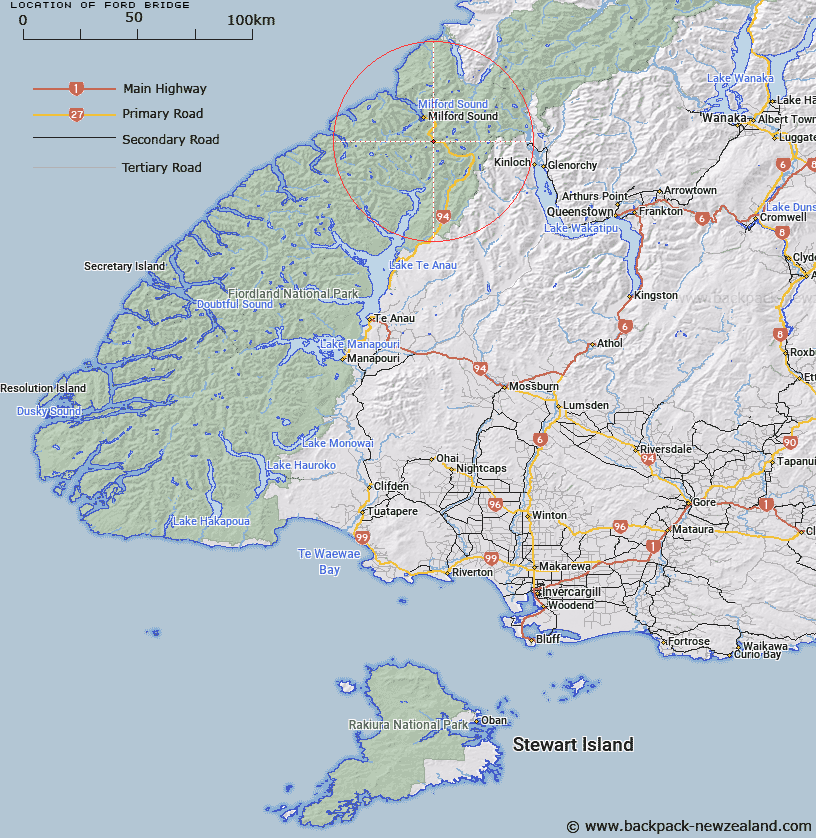
Map showing location of Ford Bridge
LINZ description: Originally a constructed rock ford on a tributary of the Cleddau River on the Te Anau - Milford road, 1.6km travel from the western end of Homer Tunnel.
Latitude: -44.759803
Longitude: 167.964023
Northing: 5031382.2
Easting: 1201428.6
Land District: Southland
Feat Type: Ford
Latitude: -44.759803
Longitude: 167.964023
Northing: 5031382.2
Easting: 1201428.6
Land District: Southland
Feat Type: Ford

Scroll down to see a more detailed road map and below that a topographical map showing the location of Ford Bridge. The road map has been supplied by openstreetmap and the topographical map of Ford Bridge has been supplied by Land Information New Zealand (LINZ).
Yes you can use the top static map for you school/university project or personal website with a link back. Contact me for any commercial use.
[ A ] [ B ] [ C ] [ D ] [ E ] [ F ] [ G ] [ H ] [ I ] [ J ] [ K ] [ L ] [ M ] [ N ] [ O ] [ P ] [ Q ] [ R ] [ S ] [ T ] [ U ] [ V ] [ W ] [ X ] [ Y ] [ Z ]