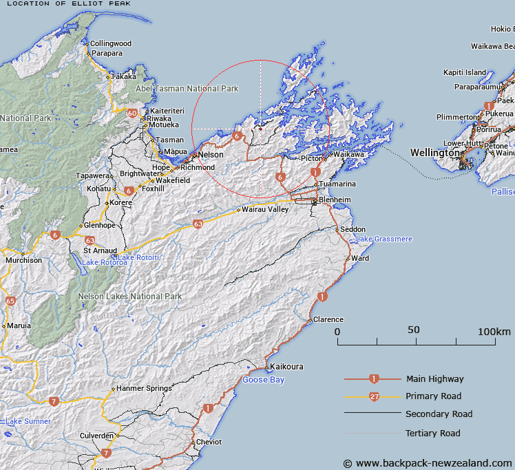
Map showing location of Elliot Peak


LINZ description: Mountain at height 861m, located in the range 2km south of Okiwi Bay, Croisilles Harbour, Marlborough Sounds.
Latitude: -41.128664
Longitude: 173.652956
Northing: 5446754.4
Easting: 1654807.9
Land District: Marlborough, Nelson
Feat Type: Hill


Scroll down to see a more detailed road map and below that a topographical map showing the location of Elliot Peak. The road map has been supplied by openstreetmap and the topographical map of Elliot Peak has been supplied by Land Information New Zealand (LINZ).

Yes you can use the top static map for you school/university project or personal website with a link back. Contact me for any commercial use.

Elliot Peak Map New Zealand


New Zealand places in our database
[ A ] [ B ] [ C ] [ D ] [ E ] [ F ] [ G ] [ H ] [ I ] [ J ] [ K ] [ L ] [ M ] [ N ] [ O ] [ P ] [ Q ] [ R ] [ S ] [ T ] [ U ] [ V ] [ W ] [ X ] [ Y ] [ Z ]


Closest 20 Hills to Elliot Peak

Editor Hill ( 2.67km )   Mount Ronga ( 3.03km )   Goat Hill ( 3.13km )   McLarens Peak ( 3.77km )   Matapehe Peak ( 3.77km )   Teranga ( 3.84km )   Symonds Hill ( 5.2km )   Clock Point Hill ( 6.12km )   South Castor Peak ( 6.25km )   North Castor Peak ( 6.28km )   Croixelles Peak ( 6.31km )   Croisilles Peak ( 6.31km )   Bush Hill ( 7.61km )   Red Hill ( 7.86km )   Lookout Peak ( 7.86km )   Gibraltar Hill ( 8.12km )   Mount McLaren ( 8.21km )   Tunapai ( 8.71km )   M?nuka Hill ( 8.94km )   Charleys Head ( 9.18km )   Mount Victoria ( 9.39km )   Tennyson ( 9.43km )   Opouri Peak ( 10.07km )   Sugar Loaf ( 10.13km )   Camp Hill ( 10.36km )   Round Hill ( 10.55km )   Goat Knob ( 10.73km )   Lagoon Hill ( 11.4km )   Scrub Hill ( 11.45km )   Maunganui ( 11.48km )   Mount Barrett ( 11.75km )   Mount Rimu ( 12.04km )   Askews Hill ( 12.18km )   Mount Rutland ( 12.71km )   Mount Stanley ( 13.8km )   Gentle Annie ( 14.29km )   Bobs Peak ( 14.94km )   Kahuroa Hill ( 16.01km )   Mount Duppa ( 16.4km )   Devils Staircase ( 17.27km )