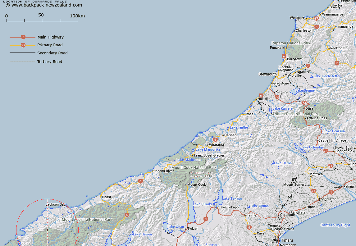
Map showing location of Durwards Falls


LINZ description: Waterfall on the Cascade River just above "Cascade Gorge"
Latitude: -44.268867
Longitude: 168.385489
Northing: 5087900
Easting: 1231700
Land District: Westland
Feat Type: Waterfall


Scroll down to see a more detailed road map and below that a topographical map showing the location of Durwards Falls. The road map has been supplied by openstreetmap and the topographical map of Durwards Falls has been supplied by Land Information New Zealand (LINZ).

Yes you can use the top static map for you school/university project or personal website with a link back. Contact me for any commercial use.

Durwards Falls Map New Zealand


New Zealand places in our database
[ A ] [ B ] [ C ] [ D ] [ E ] [ F ] [ G ] [ H ] [ I ] [ J ] [ K ] [ L ] [ M ] [ N ] [ O ] [ P ] [ Q ] [ R ] [ S ] [ T ] [ U ] [ V ] [ W ] [ X ] [ Y ] [ Z ]


Closest 20 Waterfalls to Durwards Falls

Topsey Falls ( 11.34km )   Paulin Falls ( 14.42km )   Arch Falls ( 17.95km )   Mac Falls ( 18.28km )   Ida Falls ( 20.7km )   Benmore Falls ( 22.26km )   Olivine Falls ( 23.07km )   Gorge Rapids ( 23.54km )   The Companion Ladder Rapids ( 24.33km )   Thresa Falls ( 30.76km )   Heads Leap ( 30.98km )   Turnbull Thomson Falls ( 34.27km )   Brides Veil Waterfall ( 35.59km )   Quaking Waterfall ( 37.13km )   Overshot Waterfall ( 38.56km )   Hestor Pinney Falls ( 39.25km )   Hester Pinney Falls ( 39.25km )   Wishbone Falls ( 40.52km )   Little Homer Falls ( 40.55km )   Lennox Falls ( 40.81km )   Gilkison Falls ( 41.56km )   Carrie Falls ( 42.01km )   Hindley Falls ( 43.78km )   Alexander McKay Falls ( 45.13km )   Hidden Falls ( 45.3km )   Fords Fall ( 45.85km )   Emily Falls ( 47.01km )   Leader Falls ( 49.21km )   Bridal Veil Falls ( 49.34km )   Turner Falls ( 49.95km )   Double Barrel Falls ( 51.37km )   High Falls ( 51.61km )   Humboldt Falls ( 51.61km )   Wairereata Falls ( 52.15km )   Routeburn Falls ( 52.82km )   Stirling Falls ( 55.83km )   Bowen Falls ( 57.18km )   Lyttle Falls ( 60.19km )   Twin Falls ( 60.24km )   Camp Oven Falls ( 60.91km )