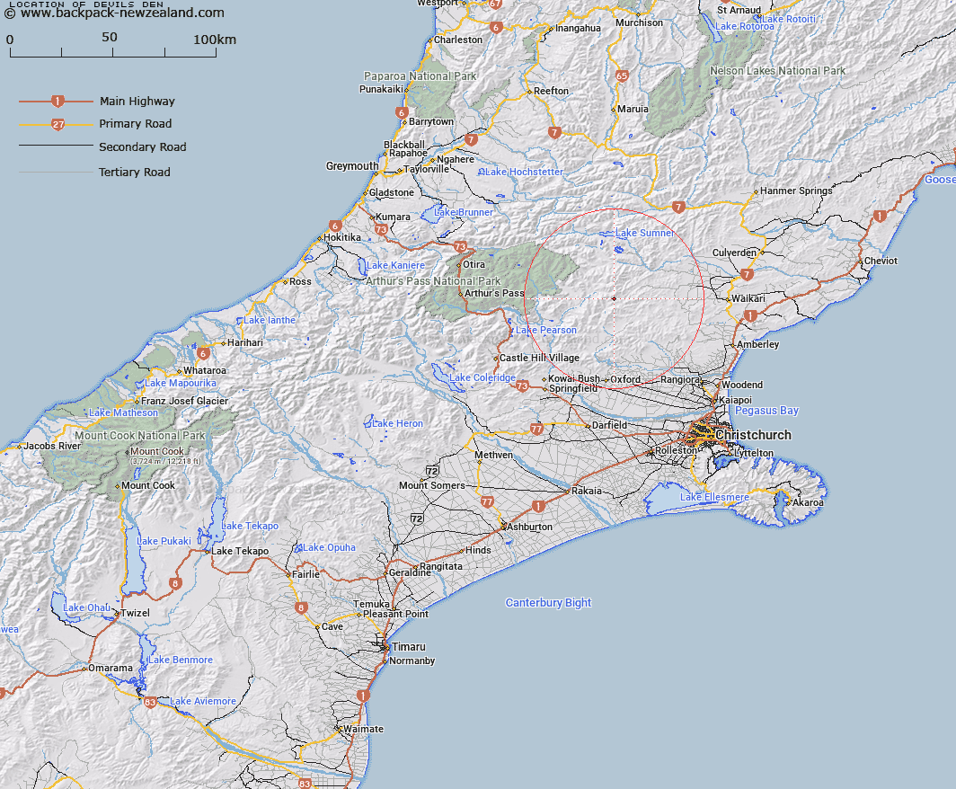
Map showing location of Devils Den


LINZ description: A basin at the headwaters of Panhandle Stream east of Ashley Head. Part of the Den Pastoral Run
Latitude: -42.963646
Longitude: 172.224289
Northing: 5242930.3
Easting: 1536735.7
Land District: Canterbury
Feat Type: Hill


Scroll down to see a more detailed road map and below that a topographical map showing the location of Devils Den. The road map has been supplied by openstreetmap and the topographical map of Devils Den has been supplied by Land Information New Zealand (LINZ).

Yes you can use the top static map for you school/university project or personal website with a link back. Contact me for any commercial use.

Devils Den Map New Zealand


New Zealand places in our database
[ A ] [ B ] [ C ] [ D ] [ E ] [ F ] [ G ] [ H ] [ I ] [ J ] [ K ] [ L ] [ M ] [ N ] [ O ] [ P ] [ Q ] [ R ] [ S ] [ T ] [ U ] [ V ] [ W ] [ X ] [ Y ] [ Z ]


Closest 20 Hills to Devils Den

Ashley Head ( 0.66km )   Mount Whatno ( 4.85km )   Mount Gordon ( 5.91km )   Mount Meehan ( 7.9km )   Block Hill ( 7.91km )   Spring Hill ( 8.2km )   Lilburne Hill ( 9.49km )   Lillburn Hill ( 9.49km )   Gola Peak ( 9.75km )   The Monument ( 10.21km )   Pancake Hill ( 10.38km )   Top of the Ladder ( 10.64km )   Esk Head ( 11.14km )   Virginia Peak ( 11.45km )   Surveyors Knob ( 11.7km )   Dampier Corner ( 12.58km )   Little Flora ( 12.77km )   Puketeraki ( 13.28km )   Madrid Hill ( 14.59km )   Big Flora ( 14.93km )   Island Hill ( 15.12km )   Mount Pember ( 15.37km )   Okuku Hill ( 15.41km )   K?nuka Hills ( 15.68km )   Nigger Hill ( 15.68km )   Retreat Hill ( 15.69km )   Tower Hill ( 15.87km )   Shingle Hill ( 16.14km )   Island Hills ( 17.03km )   Mount Noble ( 17.17km )   Double Tops ( 17.27km )   Blue Mountain ( 17.44km )   Ashley Hill ( 18.04km )   Mount Lance ( 18.15km )   Mount Turnbull ( 18.56km )   Mount Crossley ( 18.72km )   Poulter Hill ( 19.58km )   Cherry Tree Hill ( 19.99km )   Gray Hill ( 21.24km )   Mount Miza ( 21.3km )