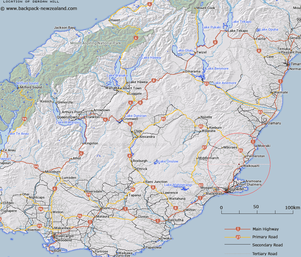
Map showing location of Derdan Hill


LINZ description: Hill at height 444m, located 3km northwest of Waikouaiti, with a beaconed trig station "A26E, D Derdan Hill" at its summit.
Latitude: -45.576412
Longitude: 170.637741
Northing: 4950300.1
Easting: 1415695
Land District: Otago
Feat Type: Hill


Scroll down to see a more detailed road map and below that a topographical map showing the location of Derdan Hill. The road map has been supplied by openstreetmap and the topographical map of Derdan Hill has been supplied by Land Information New Zealand (LINZ).

Yes you can use the top static map for you school/university project or personal website with a link back. Contact me for any commercial use.

Derdan Hill Map New Zealand


New Zealand places in our database
[ A ] [ B ] [ C ] [ D ] [ E ] [ F ] [ G ] [ H ] [ I ] [ J ] [ K ] [ L ] [ M ] [ N ] [ O ] [ P ] [ Q ] [ R ] [ S ] [ T ] [ U ] [ V ] [ W ] [ X ] [ Y ] [ Z ]


Closest 20 Hills to Derdan Hill

Mount Baldie ( 2.05km )   Mount Watkin ( 5.18km )   Mount Watkins ( 5.18km )   Mount Watkin/Hikaroroa ( 5.18km )   Mount Pleasant ( 6.81km )   Mount MacKenzie/Pakihiwitahi ( 7.37km )   Mount Mackenzie ( 7.37km )   Middle Mount ( 8.5km )   Mount Trotter ( 9.08km )   Mount Royal ( 9.14km )   Brothers Peak ( 9.59km )   Smylers Peak ( 9.83km )   Ram Rock ( 10.65km )   Taieri Peak ( 10.79km )   Whites Hill ( 11.03km )   Scratchback Hill ( 11.15km )   Mount Thomson ( 11.16km )   Guilds Hill ( 11.33km )   Jones Hill ( 11.64km )   Little Mount ( 11.65km )   Mount Scott ( 11.91km )   Puketapu ( 11.99km )   Hammond Hill ( 11.99km )   Stoney Hill ( 12.3km )   Mount Paul ( 13.04km )   Porteous Hill ( 13.48km )   Kilmog Hill ( 15.39km )   Janets Peak ( 15.62km )   Mount Royal ( 15.63km )   Lots Wife ( 17.38km )   Pukehiwitahi ( 17.48km )   Little Hummock ( 17.97km )   Swampy Hill ( 18.08km )   Nicolls Hill ( 18.24km )   Nicols Hill ( 18.24km )   Mount Misery ( 18.59km )   Harrys Peak ( 18.61km )   Alexanders Hill ( 19.13km )   Hummock ( 19.6km )   Dunback Hill ( 19.65km )