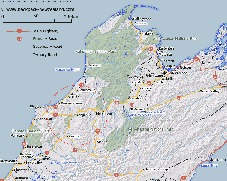
Map showing location of Dela Vedova Creek


LINZ description: Stream flowing west into the Buller River, 3km east of Inangahua
Latitude: -41.853912
Longitude: 171.988467
Northing: 5365949
Easting: 1516035.4
Land District: Nelson
Feat Type: Stream


Scroll down to see a more detailed road map and below that a topographical map showing the location of Dela Vedova Creek. The road map has been supplied by openstreetmap and the topographical map of Dela Vedova Creek has been supplied by Land Information New Zealand (LINZ).

Yes you can use the top static map for you school/university project or personal website with a link back. Contact me for any commercial use.

Dela Vedova Creek Map New Zealand


New Zealand places in our database
[ A ] [ B ] [ C ] [ D ] [ E ] [ F ] [ G ] [ H ] [ I ] [ J ] [ K ] [ L ] [ M ] [ N ] [ O ] [ P ] [ Q ] [ R ] [ S ] [ T ] [ U ] [ V ] [ W ] [ X ] [ Y ] [ Z ]


Closest 20 Streams to Dela Vedova Creek

Spring Creek ( 1.17km )   Ram Creek ( 1.43km )   De Filippi Creek ( 1.94km )   Donnybrook Stream ( 2.35km )   Dee Creek ( 2.51km )   Thomson Creek ( 2.6km )   Crowell Creek ( 3.06km )   Flaxbush Creek ( 3.25km )   Rough Creek ( 4.05km )   Gorgy Creek ( 4.42km )   McIntosh Creek ( 5.02km )   Arnolds Creek ( 5.11km )   Mountain Maid Creek ( 5.12km )   Welshman Creek ( 5.23km )   Brown Creek ( 6.1km )   Inangahua River ( 6.61km )   Camp Creek ( 6.78km )   Government Clear Creek ( 7.02km )   Pensini Creek ( 7.48km )   Little Deepdale Creek ( 7.49km )   Stable Creek ( 7.81km )   Kokopo Creek ( 7.88km )   Eden Creek ( 8.13km )   Blue Duck Creek ( 8.48km )   Foley Creek ( 8.49km )   Coal Creek ( 8.64km )   Dublin Creek ( 8.75km )   Deep Creek ( 9.45km )   Orikaka or Mackley River ( 9.8km )   Slug Stream ( 10.02km )   Hard Creek ( 10.17km )   Scotties Creek ( 10.18km )   Irishmans Creek ( 10.36km )   Fall Stream ( 10.43km )   Prythericks Creek ( 10.58km )   Winding Creek ( 10.68km )   Englishman Creek ( 10.82km )   Blue Creek ( 10.9km )   Rahui Creek ( 11km )   Brown Creek ( 11.04km )