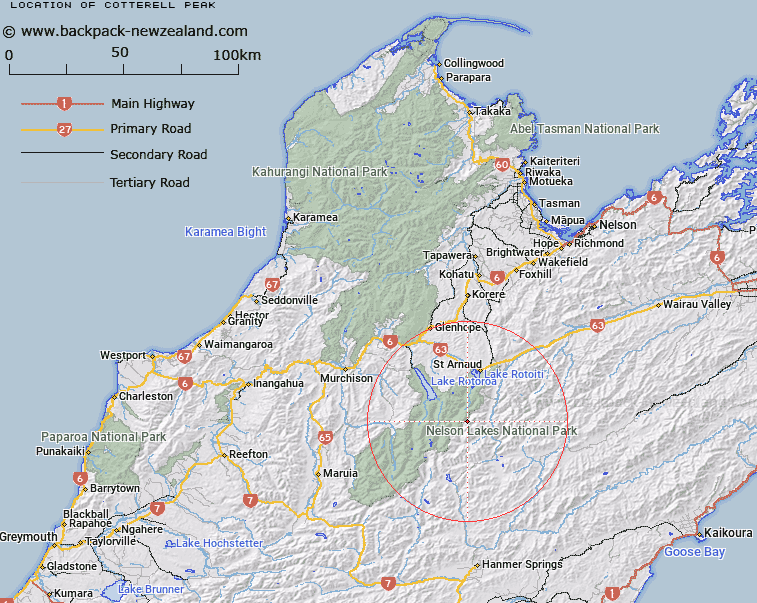
Map showing location of Cotterell Peak


LINZ description: On St. Arnaud Range at intersection with ridge dividing Begley Creek and Hamilton River. 6,890 ft. Rainbow Survey District.
Latitude: -41.991582
Longitude: 172.793862
Northing: 5351137.9
Easting: 1582925.9
Land District: Nelson
Feat Type: Hill


Scroll down to see a more detailed road map and below that a topographical map showing the location of Cotterell Peak. The road map has been supplied by openstreetmap and the topographical map of Cotterell Peak has been supplied by Land Information New Zealand (LINZ).

Yes you can use the top static map for you school/university project or personal website with a link back. Contact me for any commercial use.

Cotterell Peak Map New Zealand


New Zealand places in our database
[ A ] [ B ] [ C ] [ D ] [ E ] [ F ] [ G ] [ H ] [ I ] [ J ] [ K ] [ L ] [ M ] [ N ] [ O ] [ P ] [ Q ] [ R ] [ S ] [ T ] [ U ] [ V ] [ W ] [ X ] [ Y ] [ Z ]


Closest 20 Hills to Cotterell Peak

Mount Chittenden ( 2.91km )   The Camel ( 4.67km )   Mount Travers ( 5.43km )   Kehu Peak ( 5.8km )   Mount Cupola ( 6.15km )   Mount Hopeless ( 6.62km )   Spaniard Face ( 7.2km )   Mount Cashel ( 7.89km )   Peanter Peak ( 9.91km )   Stockyard Face ( 10km )   Angelus Peak ( 10.21km )   Maniniaro / Angelus Peak ( 10.21km )   Elise Peak ( 10.35km )   Mount McKay ( 10.82km )   Windward Peak ( 10.95km )   Mount Franklin ( 11.02km )   Mount Iris ( 11.65km )   Mount Paske ( 11.69km )   Turk Mountain ( 12.2km )   Mount Misery ( 12.23km )   Mount Cedric ( 12.69km )   Mount Weld ( 12.89km )   Mount McRae ( 12.92km )   Belvedere Peak ( 13.83km )   Julius Peak ( 14.28km )   Flagtop ( 15.52km )   Mount Dora ( 16.97km )   Mount Hutton ( 17.04km )   Mount Guinevere ( 17.73km )   Pourangahau / Mount Robert ( 17.77km )   Mount Robert ( 17.77km )   Mole Tops ( 17.88km )   Mount Mahanga ( 17.97km )   Mount Watson ( 18.2km )   Crystal Peak ( 20.17km )   Mount Ella ( 20.33km )   Mount Tarndale ( 20.39km )   Mount Maling ( 20.44km )   Playfair ( 20.89km )   Mount Balaclava ( 21km )