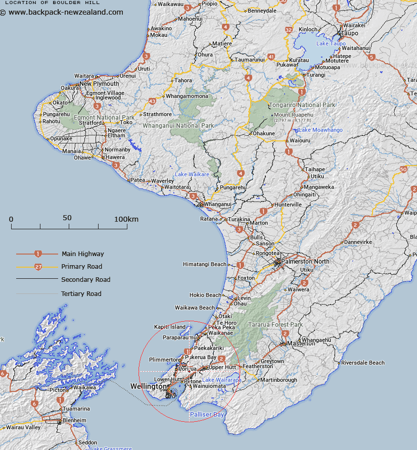
Map showing location of Boulder Hill


LINZ description: Hill 442m high in Belmont Regional Park west of Haywards and Hutt River.
Latitude: -41.15209
Longitude: 174.937017
Northing: 5442551
Easting: 1762535.3
Land District: Wellington
Feat Type: Hill


Scroll down to see a more detailed road map and below that a topographical map showing the location of Boulder Hill. The road map has been supplied by openstreetmap and the topographical map of Boulder Hill has been supplied by Land Information New Zealand (LINZ).

Yes you can use the top static map for you school/university project or personal website with a link back. Contact me for any commercial use.

Boulder Hill Map New Zealand


New Zealand places in our database
[ A ] [ B ] [ C ] [ D ] [ E ] [ F ] [ G ] [ H ] [ I ] [ J ] [ K ] [ L ] [ M ] [ N ] [ O ] [ P ] [ Q ] [ R ] [ S ] [ T ] [ U ] [ V ] [ W ] [ X ] [ Y ] [ Z ]


Closest 20 Hills to Boulder Hill

Round Knob ( 3.95km )   Cannons Head ( 4.92km )   Belmont ( 6.33km )   Baxters Knob ( 6.87km )   Maori ( 8.52km )   Puketirotiro ( 8.52km )   Mount Cooper ( 10.29km )   Whitireia/Mount Couper ( 10.29km )   Rangituhi / Colonial Knob ( 11.18km )   Colonial Knob ( 11.18km )   Devine ( 11.27km )   Mount Porirua ( 12.66km )   Cannon Point ( 12.77km )   Lowry ( 12.88km )   High Misty ( 13.19km )   Emerald Hill ( 14.99km )   Orongorongo ( 15.51km )   Puketaha ( 15.79km )   Wainui ( 15.9km )   Kaukau ( 15.98km )   Paek?k?riki Hill ( 16.17km )   Pai-a-te-Rangi ( 16.17km )   Climie ( 17.28km )   Bawbaw ( 17.61km )   The Crows Nest ( 18km )   McKerrow ( 18.21km )   Mount Crawford ( 18.25km )   Plateau ( 18.65km )   Mount Barton ( 18.74km )   Te Ahumairangi Hill ( 18.92km )   Tinakore Hill ( 18.92km )   Far Hill ( 19km )   Wry Hill ( 19.08km )   Mill Hill ( 19.12km )   Titi ( 19.64km )   Mount Grace ( 19.87km )   Mount Victoria ( 19.88km )   Middle Hill ( 20.42km )   Papatahi ( 20.58km )   British Peak ( 20.58km )