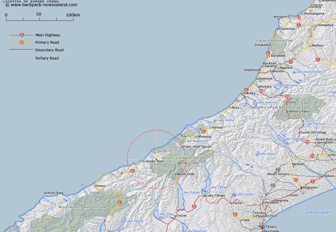
Map showing location of Border Creek


LINZ description: Right bank tributary of Karangarua River, rising 2.25km North-west of Mount Myers in the Copland Range, and flowing North-westward to join Karangarua River South of The Sugar Loaf. Blocks V and VI Karangarua Survey District.
Latitude: -43.544392
Longitude: 169.846932
Northing: 5173897.4
Easting: 1345272.4
Land District: Westland
Feat Type: Stream


Scroll down to see a more detailed road map and below that a topographical map showing the location of Border Creek. The road map has been supplied by openstreetmap and the topographical map of Border Creek has been supplied by Land Information New Zealand (LINZ).

Yes you can use the top static map for you school/university project or personal website with a link back. Contact me for any commercial use.

Border Creek Map New Zealand


New Zealand places in our database
[ A ] [ B ] [ C ] [ D ] [ E ] [ F ] [ G ] [ H ] [ I ] [ J ] [ K ] [ L ] [ M ] [ N ] [ O ] [ P ] [ Q ] [ R ] [ S ] [ T ] [ U ] [ V ] [ W ] [ X ] [ Y ] [ Z ]


Closest 20 Streams to Border Creek

Scotts Creek ( 0.86km )   Hobson Creek ( 1.96km )   Havelock Creek ( 2.4km )   Rough Creek ( 4.2km )   Ohinetamatea River (Saltwater River) ( 4.21km )   Black Creek ( 5.25km )   Chlorite Creek ( 5.77km )   Ohinetamatea River ( 5.8km )   K?marupeka Creek ( 6.26km )   Maimai Creek ( 6.33km )   Katau Creek ( 6.47km )   Architect Creek ( 7.37km )   McPhee Creek ( 7.39km )   Copland River ( 7.6km )   Bullock Creek ( 8.32km )   T?t?wh?k? Creek ( 8.34km )   Vickers Creek ( 8.64km )   Nicholson Creek ( 8.77km )   McTaggart Creek ( 8.8km )   Bullock Creek ( 9.14km )   Driblet Creek ( 9.51km )   Hermit Creek ( 9.71km )   Palaver Creek ( 9.83km )   Harkells Creek ( 10.11km )   Cook River/Weheka ( 10.14km )   Cook River ( 10.14km )   Boyds Creek ( 10.26km )   Open Creek ( 10.4km )   McBain Creek ( 10.79km )   Gordon Creek ( 10.85km )   Ribbonwood Creek ( 10.85km )   Scotchmans Creek ( 10.86km )   Karangarua River ( 10.88km )   Gordon Creek ( 10.97km )   Therma Creek ( 10.99km )   Hunt Creek ( 11.21km )   Ohinetamatea River (Saltwater Creek) ( 11.44km )   Shiels Creek ( 11.45km )   Manakaiaua River ( 11.64km )   McLellan Creek ( 11.77km )