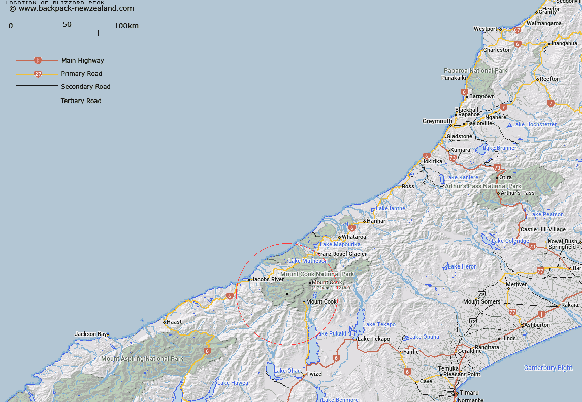
Map showing location of Blizzard Peak


LINZ description: 2435m peak between Pioneer and Scott Peaks on The Sierra Range above Wicks Glacier.
Latitude: -43.676433
Longitude: 169.969371
Northing: 5159600
Easting: 1355700
Land District: Westland
Feat Type: Hill


Scroll down to see a more detailed road map and below that a topographical map showing the location of Blizzard Peak. The road map has been supplied by openstreetmap and the topographical map of Blizzard Peak has been supplied by Land Information New Zealand (LINZ).

Yes you can use the top static map for you school/university project or personal website with a link back. Contact me for any commercial use.

Blizzard Peak Map New Zealand


New Zealand places in our database
[ A ] [ B ] [ C ] [ D ] [ E ] [ F ] [ G ] [ H ] [ I ] [ J ] [ K ] [ L ] [ M ] [ N ] [ O ] [ P ] [ Q ] [ R ] [ S ] [ T ] [ U ] [ V ] [ W ] [ X ] [ Y ] [ Z ]


Closest 20 Hills to Blizzard Peak

Splinter Peak ( 1.3km )   Pioneer Peak ( 1.7km )   Scott Peak ( 2.73km )   Mount Glorious ( 3.16km )   The Gladiator Peak ( 3.93km )   The Pommel ( 4.39km )   Mount Howitt ( 4.92km )   Mount Brunner ( 5.03km )   Mount Stephen ( 5.19km )   Sharks Teeth ( 5.37km )   Mount Thomson ( 5.43km )   Mount Thompson ( 5.43km )   The Helmet ( 5.53km )   Mount Sefton ( 5.89km )   Notable Peak ( 6.28km )   Awatea Peak ( 6.42km )   Mount Peculiar ( 6.53km )   Eagle Peak ( 6.65km )   Mount Mirk ( 6.84km )   Price Peak ( 6.92km )   Mount Isabel ( 7.12km )   Mount Eric ( 7.19km )   Maunga Ma ( 7.21km )   Vampire ( 7.56km )   The Footstool ( 7.59km )   Mount Townsend ( 7.63km )   MacKnob ( 7.73km )   Mount Burns ( 7.75km )   Shiels Peak ( 7.79km )   Mount Vexation ( 7.81km )   Mount Bannie ( 7.85km )   The Clue ( 8.37km )   Cadogan Peak ( 8.43km )   Watch Tower ( 8.68km )   Mount Montgomery ( 9.01km )   Mount Montgomerie ( 9.01km )   The Fang ( 9.15km )   Conical Hill ( 9.18km )   Misty Peak ( 9.19km )   Sibyl Peak ( 9.28km )