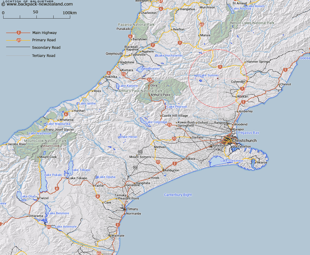
Map showing location of Balquether


LINZ description: Peak, approximate height 1337m on the Organ Range, 1.75km North-west of peak Sunny Knob [Trig. Z (Geodetic Code B282)]. Block VIII Mytholm Survey District.
Latitude: -42.736965
Longitude: 172.467798
Northing: 5268256.8
Easting: 1556436.4
Land District: Canterbury
Feat Type: Hill


Scroll down to see a more detailed road map and below that a topographical map showing the location of Balquether. The road map has been supplied by openstreetmap and the topographical map of Balquether has been supplied by Land Information New Zealand (LINZ).

Yes you can use the top static map for you school/university project or personal website with a link back. Contact me for any commercial use.

Balquether Map New Zealand


New Zealand places in our database
[ A ] [ B ] [ C ] [ D ] [ E ] [ F ] [ G ] [ H ] [ I ] [ J ] [ K ] [ L ] [ M ] [ N ] [ O ] [ P ] [ Q ] [ R ] [ S ] [ T ] [ U ] [ V ] [ W ] [ X ] [ Y ] [ Z ]


Closest 20 Hills to Balquether

Sunny Knob ( 1.78km )   La Grippe ( 4.02km )   Clay Knob ( 4.82km )   Silverton ( 5.57km )   Mount Roderick ( 5.82km )   Mons Boreas ( 5.91km )   Spider Web ( 6.11km )   Dampier Knob ( 6.33km )   Mount Catherine ( 6.7km )   Nicholsons Knob ( 6.88km )   Mount Skedaddle ( 7.22km )   Jollie Brook ( 7.42km )   Mount Skiddaw ( 8.69km )   Scaw Fell ( 8.71km )   Ben Cliberick ( 8.97km )   Pig Hill ( 10.18km )   Mount Pan ( 10.19km )   Hurunui Peak ( 10.72km )   Mount Miza ( 10.83km )   Mount Jonathan ( 10.95km )   Mount Selfe ( 11.02km )   Cloudy Hill ( 12.06km )   Coopers Knob ( 12.39km )   Seven Hills ( 13.15km )   Mount Edison ( 13.54km )   Little Sisters ( 13.79km )   Cherry Tree Hill ( 13.99km )   Mount Kakapo ( 14.1km )   Charing Cross ( 14.3km )   Mount Oval ( 14.63km )   Mount Longfellow ( 15.31km )   Mount Tekoa ( 15.32km )   Te Kooti ( 15.55km )   Frozen Hill ( 15.77km )   Mount Noble ( 15.95km )   Neschacker Hill ( 16.71km )   Windy Knob ( 16.9km )   Green Hill ( 17.51km )   Mount Mason ( 17.71km )   Mount Emerson ( 17.78km )