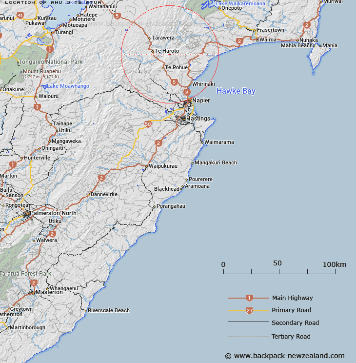
Map showing location of Ahu-o-te-Atua


LINZ description: A hill at 1271 m east of Maungaharuru Range approximately 40 km northwest of Napier. NZTopo50-BH38 228601.
Latitude: -39.148465
Longitude: 176.735115
Northing: 5660100
Easting: 1922800
Land District: Hawke's Bay
Feat Type: Hill


Scroll down to see a more detailed road map and below that a topographical map showing the location of Ahu-o-te-Atua. The road map has been supplied by openstreetmap and the topographical map of Ahu-o-te-Atua has been supplied by Land Information New Zealand (LINZ).

Yes you can use the top static map for you school/university project or personal website with a link back. Contact me for any commercial use.

Ahu-o-te-Atua Map New Zealand


New Zealand places in our database
[ A ] [ B ] [ C ] [ D ] [ E ] [ F ] [ G ] [ H ] [ I ] [ J ] [ K ] [ L ] [ M ] [ N ] [ O ] [ P ] [ Q ] [ R ] [ S ] [ T ] [ U ] [ V ] [ W ] [ X ] [ Y ] [ Z ]


Closest 20 Hills to Ahu-o-te-Atua

Taraponui ( 1.7km )   Kopua ( 2.96km )   Patikiakai ( 4.22km )   Titiokura Summit ( 8km )   Whakaterehu ( 9.45km )   Te Waka ( 11.18km )   Otangihia ( 12.59km )   Turangakumu Summit ( 12.68km )   Purahotangihia ( 13.72km )   P?rahoitangihia ( 13.72km )   Kingma Peak ( 14.01km )   Tahau ( 14.82km )   Te Kooti's Lookout ( 16.62km )   Rakaita ( 17.42km )   Te Ipuohape ( 18.01km )   Kokohitoa ( 19.37km )   Wharangi ( 19.52km )   Hukanui ( 19.77km )   Taumatakaiamu ( 21.59km )   Kotoko ( 22.11km )   Dunmore ( 22.49km )   The Dome ( 22.59km )   Pohokura ( 22.98km )   Tunurangi ( 23.67km )   Rongomaipapa ( 24.71km )   Komataoneone ( 25km )   Kaimatangi ( 25.27km )   Rangipuketu ( 25.34km )   Te Rata ( 25.99km )   Wharerangiora ( 26.96km )   Baldy ( 27.64km )   Te Matai ( 27.69km )   Kotaumataopurua ( 27.9km )   Tirohanga ( 28.08km )   Waitore ( 28.27km )   Te Ihuorurumaioterangi ( 28.66km )   Panemanga ( 28.84km )   Otumakiore ( 29.17km )   Ngapouatu ( 29.95km )   Upokokahara ( 30.27km )