Kirwans Track
Quick Facts
- Distance: 34km
- Time: 2 - 3 Days
- Grade: Medium
- Higest point: 1295 m
- Island: South
- Location: Victoria Forest Park
- Map: Reefton L30
The features of this tramp are the superb views overlooking the Paparoa and Victoria ranges. Mt Cook and Tasman can also be seen towering above all others in the far distance.
The track is located in Victoria Forest Park and access is down Boatmans Road to Capleston, 17km north of the historic town of Reefton. Back in 1877 Capleston boasted seven hotels and 1000 people, all that remains today is the odd bit of timber lying around.
A few guide books I have read suggest that it is best to head up to Kirwans Hut and return the same way. I would disagree as the walk down to Montgomerie Hut offers not only old mining relics but the valley itself is very pretty. However if you wanted to complete this in 2 days you are best heading back the same way as the walk out via Montgomerie Hut is at least 8 hours.
We did this track in winter and we unintentionally planned it to perfection, a clear sunny day on the tops, full moon and a nice sunset made this track that much better. If you decide to do it in winter bring lots of warm clothing and be prepared for snow.
Capleston - Kirwans Hut: 10 km, 6 - 7 hours
The track starts off by following an old vehicle track for 1 km until it reaches Boatmans Creek. You may find yourself at this point pondering where the track disappeared to! Don't despair, a few metres up-steam you will find a tunnel with a swing-bridge at the other end crossing Boatmans Creek. This tunnel was build during the gold mining days.
The track then ambles along for 2 1/2 km sticking close to but mostly above Boatmans Creek until it reaches Topler Creek. After crossing Topler Creek the track gradually winds its way up the hill. After 5 or so km you will come to a clearing looking back the way you came.
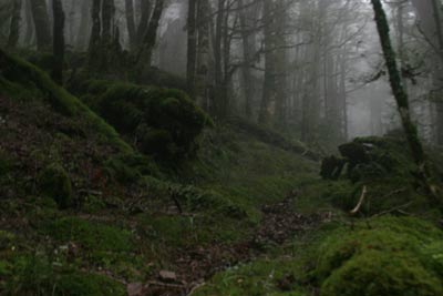
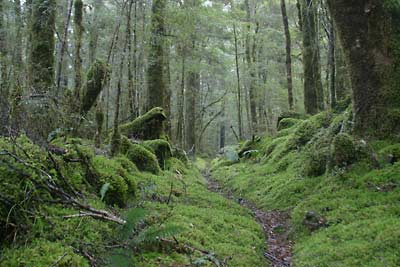
The track then flattens out somewhat but continues to climb for a further 2 km's. We left the car park at 2pm and by the time we got to this point it was getting dark, the darkness combined with the mist and gnarled moss covered beech trees gave it a real magical atmosphere, I wouldn't of flinched if a hobbit popped out from behind a tree.
You will then come to a side track, this leads up to the site of a old gold miners hut, it's only a few minutes off the main track but it's still not really worth it. There are just a few bits of wood and corrugated iron lying around. Don't fret if you were hoping this was going to lead to the hut, it's only a further 10 minute down the main track to the next side track that leads to the hut, and you will be happy to know that the 20 minute's that the sign says to Kirwans Hut (12 bunks, serviced) is only about 10.
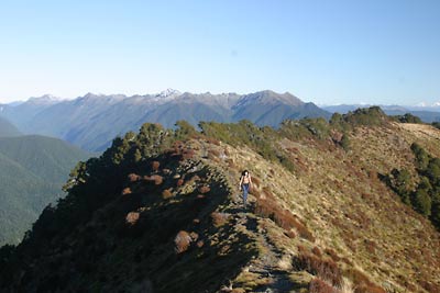
Side trip: Kirwans Hill
You would of past the track that leads to the hill about halfway between the hut and the main track. It's about a 1km walk through forrest until it opens up and climbs for a further 1km. It is well worth the trip if the weather is fine. We spent hours up there just soaking in the views waiting for the spectacular sunset and moon rise that greeted us.
Kirwans Hut - Montgomerie Hut: 6km, 4hrs
Walk back down to rejoin the main track. The track then gently decends passing a track that leads to Kirwans Reward mine and several clearings with old gold mining relics. You will then come to a old iron wheel, this was used to carry ore down to the battery. It worked by gravity with full buckets of ore carried down the wire rope and the weight brought the empty buckets back to the top.
Continuing down the track for a further 500 m you will come to the pretty Kirwans Creek. The track then follows the creek for a further 2 km until the confluence with Montgomerie river, the Lord Bassey stamping battery is about halfway between Kirwans Creek and Montgomerie.
The last section is following the 4WD track for some 14 km to Gannons Bridge. If you brought a tent there is plenty of excellent camping and fishing spots along side the river. This section gets a bit on the monotonous side and Gannons Bridge will be a welcome site.
The track then winds it's way up from Gannons Bridge opening up at the top to offer some nice views back towards Reefton and the farming communities. At the top the track makes it's way through forestry roads for about 1.5km until it decends back into the native bush down into Capleston and the car park.