Inland Pack Track
Quick Facts
- Distance: 25 km
- Time: 1-2 days
- Grade: Easy / Moderate
- Higest point: 200 m
- Island: South
- Location: Paparoa National Park
- Map: Punakaiki K30

The track is 25 km long and the recommended time to complete it is 2 days, I completed it in a day but only cause a storm was predicted for that night.
There are no huts on this track so a tent is recommended and there is lots of excellent camping spots along the track, there is also the impressive limestone overhang known as the Ballroom where you can either pitch a tent or sleep on a roll mat. A gas cooker should also be carried.

Warning: There are numerous river crossings and the the walk from Fossil Creek to Fox River/Dilemma Creek junction involves walking along side and through the creek, and these rivers and creeks can rise quickly following rainfall.
Punakaiki River - Ballroom: 20 km, 8 hrs Although this section is 20 km, you could split it over 2 days if you have a tent as there are numerous camp sites.
The track starts of being well graded and easy walking, it slowly climbs to 150 m then gently descends. Just before Pororari River you will come to a fork in the track, the track on your right is the Pororari River Track. Cross the Pororari River where you can safely. Stick to the track on this section as there are numerous limestone sinkholes and potholes, continue for 4 1/2 Km of easy travel until you come to a farm road. Follow the farm road for about 500 m and cross Bullock Creek where the markers are. Continue along the road again until the track resumes.
The track then gently climbs again, flattens out for a while then climbs slightly more steeply to a ridge at 200 m. On a fine day you should be able to see Mt Flemming and Mt Euclid from this point. For the next 1 km the track descends until you come to Fossil Creek. Follow Fossil Creek for 30 minutes and you will come to the confluence with Dilemma Creek.
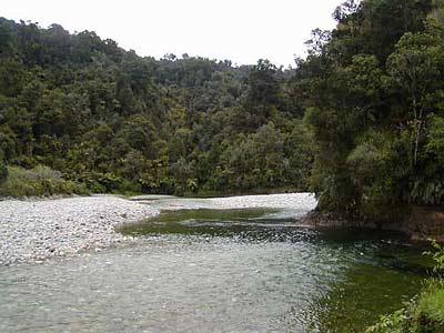
Fox River/Dilemma Creek Junction - Fox River Mouth: 5 km, 1 1/2 hours If you went to the Ballroom Overhang rejoin the track on the true left of the Fox River. The track continues on the left side of the Fox River occasionally climbing and dropping. After 2 km cross the wide Fox River to the true right side of the river. For the last 3 km follow Fox River down occasionally walking on the riverbed until you come to a short road that leads to the main highway (SH6) on the West Coast.