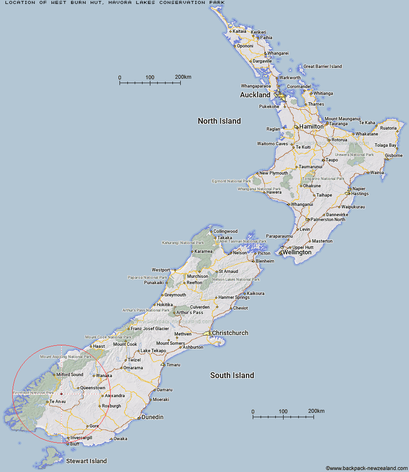
Topo Map showing location of West Burn Hut
This information is sourced from DoC, LINZ and Openstreetmap. Some of the hut photos are mine and the rest are from DoC. I will be adding an upload feature soon so people can photos of .West Burn Hut.
Basic info: basic six-bunk hut in the Southland area.
Latitude: -45.2062250819
Longitude: 168.154150979
Location: Mavora Lakes Conservation Park
Area: Southland
Type of Hut: Basic/bivvies
Map: CC09 Topo Map | Road Map
Does this hut still exist? Have any more information? Contact
Basic info: basic six-bunk hut in the Southland area.
Latitude: -45.2062250819
Longitude: 168.154150979
Location: Mavora Lakes Conservation Park
Area: Southland
Type of Hut: Basic/bivvies
Map: CC09 Topo Map | Road Map
Does this hut still exist? Have any more information? Contact
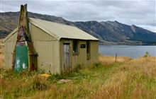
Image: DoC
Scroll down to see a topographical map and road map showing the location of West Burn Hut
[ A ] [ B ] [ C ] [ D ] [ E ] [ F ] [ G ] [ H ] [ I ] [ J ] [ K ] [ L ] [ M ] [ N ] [ O ] [ P ] [ Q ] [ R ] [ S ] [ T ] [ U ] [ V ] [ W ] [ Y ] [ Z ]
Closest 20 Huts to West Burn Hut
These are as the crow fliesWest Burn Hut 0km Careys Hut 2.16km Boundary Hut 7.66km Forks Hut 10.48km Army Hut 11.41km Kiwi Burn Hut 17.28km Taipo Hut 18.13km Upper Oreti Hut 19.47km Lincoln Hut 20.91km Ashton Hut 21.72km Dog Box Bivouac 26.08km Greenstone Hut 26.63km Upper Windley Hut 26.78km Saint Marys Hut 26.9km Steele Creek Lodge 27.57km Billy Hut 27.82km Rats Nest Hut 29.14km Slip Flat Hut 29.34km Upper Cromel Hut 29.88km Oreti Hut 30.71km Cowshed Hut 30.92km Shepherd Creek Hut 30.93km Irthing Hut 30.99km Islands Hut 31.05km Steele Creek Hut 31.4km Lower Windley Hut 33.58km Home Hill Hut 33.71km Cromel Branch Hut 33.79km Sam Summers Hut 34.45km Siberia Hut 35.65km Mid Caples Hut 36.18km Ross Hut 36.18km Glade House 36.29km McKellar Hut 37.2km McKellar Lodge 37.42km Long Burn Hut 38.04km Clinton Hut 38.58km Worsley Hut 38.64km Mansion Hut 38.87km Mitchells Hut 39.36km