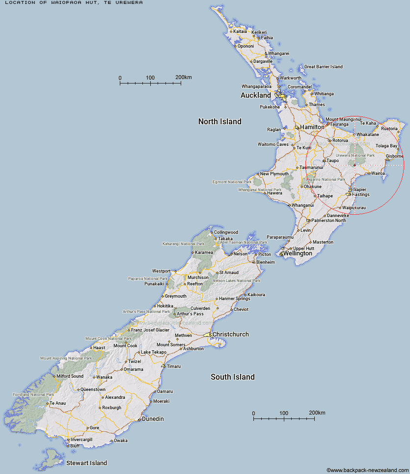
Topo Map showing location of Waiopaoa Hut
This information is sourced from DoC, LINZ and Openstreetmap. Some of the hut photos are mine and the rest are from DoC. I will be adding an upload feature soon so people can photos of .Waiopaoa Hut.
Basic info: 30-bunk hut located on the Waikaremoana Track in the Te Urewera area.
Latitude: -38.8089681662
Longitude: 176.993979397
Location: Te Urewera
Area: East Coast
Type of Hut: Great Walk
Tracks: Lake Waikaremoana
Map: BG39 Topo Map | Road Map
Does this hut still exist? Have any more information? Contact
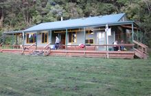
Image: DoC
Scroll down to see a topographical map and road map showing the location of Waiopaoa Hut
[ A ] [ B ] [ C ] [ D ] [ E ] [ F ] [ G ] [ H ] [ I ] [ J ] [ K ] [ L ] [ M ] [ N ] [ O ] [ P ] [ Q ] [ R ] [ S ] [ T ] [ U ] [ V ] [ W ] [ Y ] [ Z ]
Closest 20 Huts to Waiopaoa Hut
These are as the crow fliesMarauiti Hut 4.61km Panekire Hut 5.02km Waiharuru Hut 8km Whanganui Hut 10.59km Te Waiotukapiti Hut 11.95km Whakatakaa Hut 12.97km Central Waiau Hut 13.53km Te Totara Hut 13.53km Rogers Hut (Te Wairoa) 18.81km Mangakahika Hut 19.18km Skips Hut (Whangatawhia) 19.47km Manuoha Hut 20.25km Central Te Hoe Hut 20.73km Sandy Bay Hut 20.74km Kanohirua Hut 23.12km Upper Te Hoe Hut 23.98km Moerangi Hut 24.4km Mangamate Hut 27.09km Waiawa Hut 27.51km Upper Whirinaki Hut 27.82km Vern's Camp Shelter 28.85km Central Whirinaki Hut 29.87km Makomako Hut 32.5km Tawhiwhi Hut 32.99km Mangapouri Hut 33.43km Taurawharona Hut 33.72km Mangatoatoa Hut 34.69km Ngahiramai Hut 35.23km Otanetea Hut 35.78km Upper Matakuhia Hut 35.78km Okui Hut 36.13km Takurua Hut 36.55km Te Rangaakapua Hut 36.83km Lower Matakuhia Hut 36.93km Halfway Hut 38.74km Te Pua Hut 39.89km Te Panaa Hut 39.9km Hanamahihi Hut 42.26km Makakoere Hut 42.92km Otane Hut 43.46km