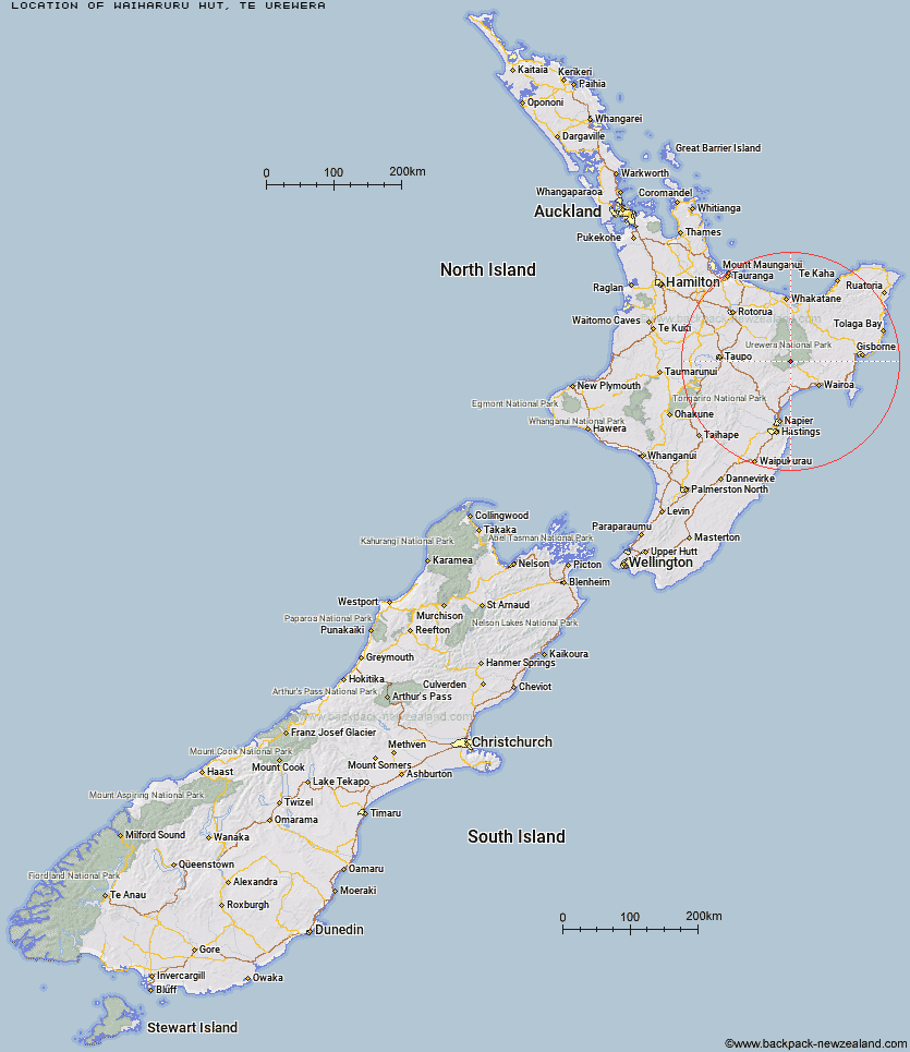
Topo Map showing location of Waiharuru Hut
This information is sourced from DoC, LINZ and Openstreetmap. Some of the hut photos are mine and the rest are from DoC. I will be adding an upload feature soon so people can photos of .Waiharuru Hut.
Basic info: 40-bunk hut located on the Waikaremoana Track in the Te Urewera area.
Latitude: -38.743603608
Longitude: 177.032582096
Location: Te Urewera
Area: East Coast
Type of Hut: Great Walk
Tracks: Lake Waikaremoana
Map: BG40 Topo Map | Road Map
Does this hut still exist? Have any more information? Contact
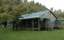
Image: DoC
Scroll down to see a topographical map and road map showing the location of Waiharuru Hut
[ A ] [ B ] [ C ] [ D ] [ E ] [ F ] [ G ] [ H ] [ I ] [ J ] [ K ] [ L ] [ M ] [ N ] [ O ] [ P ] [ Q ] [ R ] [ S ] [ T ] [ U ] [ V ] [ W ] [ Y ] [ Z ]
Closest 20 Huts to Waiharuru Hut
These are as the crow fliesWhanganui Hut 2.62km Marauiti Hut 4.15km Whakatakaa Hut 6.3km Panekire Hut 7.84km Waiopaoa Hut 8km Manuoha Hut 12.38km Te Totara Hut 13.84km Sandy Bay Hut 14.36km Kanohirua Hut 15.72km Central Waiau Hut 16.33km Te Waiotukapiti Hut 17km Waiawa Hut 19.89km Skips Hut (Whangatawhia) 20.33km Rogers Hut (Te Wairoa) 21.12km Mangakahika Hut 23.59km Makomako Hut 24.52km Taurawharona Hut 25.89km Tawhiwhi Hut 25.99km Mangatoatoa Hut 26.7km Moerangi Hut 26.8km Central Te Hoe Hut 26.83km Otanetea Hut 28.19km Ngahiramai Hut 28.34km Te Rangaakapua Hut 28.87km Mangapouri Hut 28.9km Upper Te Hoe Hut 29.12km Takurua Hut 29.35km Mangamate Hut 29.82km Vern's Camp Shelter 30.64km Te Pua Hut 31.96km Te Panaa Hut 32.09km Upper Whirinaki Hut 32.1km Okui Hut 32.14km Central Whirinaki Hut 33.06km Makakoere Hut 34.98km Hanamahihi Hut 35.47km Otane Hut 35.48km Tataweka Hut 35.67km Kahunui Hut 36.22km Te Pourewa Hut 36.5km