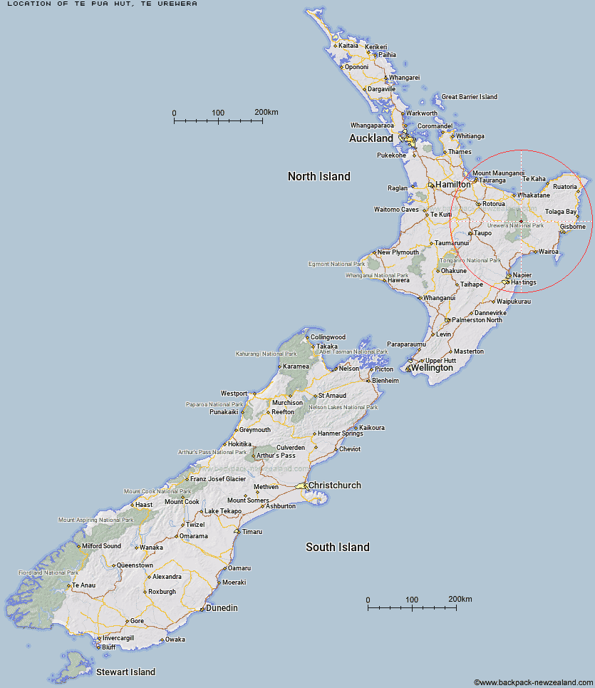
Topo Map showing location of Te Pua Hut
This information is sourced from DoC, LINZ and Openstreetmap. Some of the hut photos are mine and the rest are from DoC. I will be adding an upload feature soon so people can photos of .Te Pua Hut.
Basic info: standard six-bunk hut in the Te Urewera area.
Latitude: -38.4676047917
Longitude: 177.135171743
Location: Te Urewera
Area: East Coast
Type of Hut: Standard
Map: BF40 Topo Map | Road Map
Does this hut still exist? Have any more information? Contact
Basic info: standard six-bunk hut in the Te Urewera area.
Latitude: -38.4676047917
Longitude: 177.135171743
Location: Te Urewera
Area: East Coast
Type of Hut: Standard
Map: BF40 Topo Map | Road Map
Does this hut still exist? Have any more information? Contact
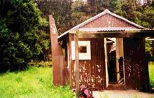
Image: DoC
Scroll down to see a topographical map and road map showing the location of Te Pua Hut
[ A ] [ B ] [ C ] [ D ] [ E ] [ F ] [ G ] [ H ] [ I ] [ J ] [ K ] [ L ] [ M ] [ N ] [ O ] [ P ] [ Q ] [ R ] [ S ] [ T ] [ U ] [ V ] [ W ] [ Y ] [ Z ]
Closest 20 Huts to Te Pua Hut
These are as the crow fliesTe Panaa Hut 3.16km Otane Hut 4.15km Te Pourewa Hut 5.7km Taurawharona Hut 6.57km Mangatoatoa Hut 7.26km Tataweka Hut 7.36km Otanetea Hut 7.55km Makomako Hut 7.66km Otapukawa Hut 8.44km Te Rangaakapua Hut 8.46km Makakoere Hut 9.96km Takurua Hut 11.26km Ohane Hut 11.66km Tawa Hut 11.72km Kahunui Hut 12.41km Waiawa Hut 13.26km Tawhiwhi Hut 13.62km Ngahiramai Hut 13.98km Waikare Junction Hut 14.32km Koaunui Hut 14.43km Koranga Forks Hut 15.41km Hanamahihi Hut 15.9km Onepu Hut 17.27km Kanohirua Hut 17.85km Nikau Flat Hut 18.4km Ohora Hut 19.88km Manaohou Right Branch Hut 19.89km Manuoha Hut 21km Kotepato Hut 22.41km Duckville Hut 25.19km Apiti Hut 25.49km Wharekahika Hut 25.81km Casino Hut 26.09km Sandy Bay Hut 26.35km Saddle (Mangaawai) Hut 27.38km Mangapouri Hut 27.49km Horomanga Base Camp 27.55km Whakatakaa Hut 27.57km Mangamako Hut 28.45km Twain (Waipotiki) Hut 29.19km