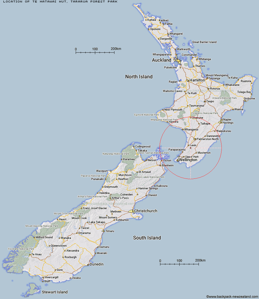
Topo Map showing location of Te Matawai Hut
This information is sourced from DoC, LINZ and Openstreetmap. Some of the hut photos are mine and the rest are from DoC. I will be adding an upload feature soon so people can photos of .Te Matawai Hut.
Basic info: standard 18-bunk hut in the Kapiti region.
Latitude: -40.7375359806
Longitude: 175.398665908
Location: Tararua Forest Park
Area: Wellington/Kapiti
Type of Hut: Standard
Tracks: Tararua Northern Crossing
Map: BN33 Topo Map | Road Map
Does this hut still exist? Have any more information? Contact
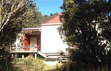
Image: DoC
Scroll down to see a topographical map and road map showing the location of Te Matawai Hut
[ A ] [ B ] [ C ] [ D ] [ E ] [ F ] [ G ] [ H ] [ I ] [ J ] [ K ] [ L ] [ M ] [ N ] [ O ] [ P ] [ Q ] [ R ] [ S ] [ T ] [ U ] [ V ] [ W ] [ Y ] [ Z ]
Closest 20 Huts to Te Matawai Hut
These are as the crow fliesSouth Ohau Hut 2.29km Arete Hut 3.45km Dracophyllum Hut 3.65km Waiopehu Hut 3.73km North Ohau Hut 4.52km Arete Forks Hut 5.69km Carkeek Hut 5.86km Mangahao Flats Hut 5.98km Dundas Hut 6.14km Tarn Ridge Hut 6.7km Dorset Ridge Hut 8.04km Nichols Hut 8.31km Cattle Ridge Hut 8.87km Cow Creek Hut 8.92km McGregor Bivouac 10.63km Roaring Stag Hut 10.64km Mid King Bivouac 10.84km Herepai Hut 11.64km Blue Range Hut 11.86km Mitre Flats Hut 12.35km Anderson Memorial Hut 12.63km Waikawa Shelter 12.91km Waitewaewae Hut 12.98km Jumbo Hut 13.44km Mid Waiohine Hut 15.25km Atiwhakatu Hut 15.26km Powell Hut 16.52km Burn Hut 17.03km Aokaparangi Hut 17.46km Mountain House Shelter 17.68km Maungahuka Hut 20.18km Penn Creek Hut 20.54km Totara Flats Hut 21.7km Neill Forks Hut 22km Field Hut 22.41km Sayer Hut 23.24km Kime Hut 25.2km North Mangahao Bivouac 27.94km Cone Hut 28.13km Kapakapanui Hut 28.58km