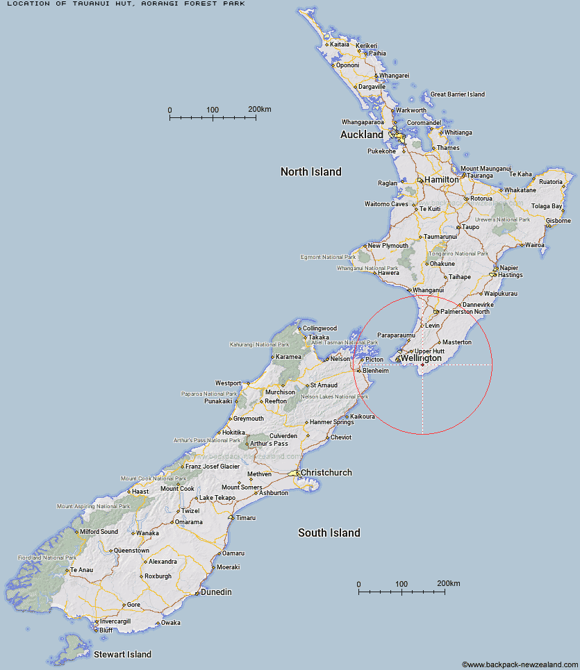
Topo Map showing location of Tauanui Hut
This information is sourced from DoC, LINZ and Openstreetmap. Some of the hut photos are mine and the rest are from DoC. I will be adding an upload feature soon so people can photos of .Tauanui Hut.
Basic info: standard six-bunk hut in the Wairarapa region.
Latitude: -41.3877661912
Longitude: 175.305047219
Location: Aorangi Forest Park
Area: Wairarapa
Type of Hut: Standard
Map: BQ33 Topo Map | Road Map
Does this hut still exist? Have any more information? Contact
Basic info: standard six-bunk hut in the Wairarapa region.
Latitude: -41.3877661912
Longitude: 175.305047219
Location: Aorangi Forest Park
Area: Wairarapa
Type of Hut: Standard
Map: BQ33 Topo Map | Road Map
Does this hut still exist? Have any more information? Contact
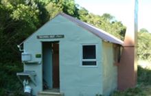
Image: DoC
Scroll down to see a topographical map and road map showing the location of Tauanui Hut
[ A ] [ B ] [ C ] [ D ] [ E ] [ F ] [ G ] [ H ] [ I ] [ J ] [ K ] [ L ] [ M ] [ N ] [ O ] [ P ] [ Q ] [ R ] [ S ] [ T ] [ U ] [ V ] [ W ] [ Y ] [ Z ]
Closest 20 Huts to Tauanui Hut
These are as the crow fliesSutherlands Hut 5.84km Washpool Hut 10km Pararaki Hut 12.78km Kawakawa Hut 15.93km Wharepapa Hut 20.41km Mangatoetoe Hut 20.46km Waiorongomai Hut 22.08km Papatahi Hut 24.85km Haurangi Hut 26.53km Jans Hut 27.43km Waerenga Hut 27.85km Boar Inn 28.4km Paua Hut 28.68km Barneys Whare 30.32km Smith Creek Shelter 37.16km Eastern Hutt Hut 41.51km Tutuwai Hut 42.02km Waiohine Shelter 42.88km Cone Hut 44.66km Alpha Hut 44.74km Elder Hut 46.64km Renata Hut 47.94km Kime Hut 49.55km Sayer Hut 49.63km Neill Forks Hut 50.78km Waiotauru Hut 50.89km Totara Flats Hut 51.26km Maungahuka Hut 52.93km Field Hut 53.52km Kapakapanui Hut 53.83km Penn Creek Hut 54.09km Aokaparangi Hut 55.34km Mountain House Shelter 55.85km Powell Hut 56.81km Mid Waiohine Hut 57.48km Atiwhakatu Hut 59.11km Anderson Memorial Hut 60.34km Jumbo Hut 60.38km Waitewaewae Hut 61.91km McGregor Bivouac 62.35km