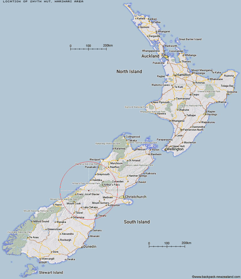
Topo Map showing location of Smyth Hut
This information is sourced from DoC, LINZ and Openstreetmap. Some of the hut photos are mine and the rest are from DoC. I will be adding an upload feature soon so people can photos of .Smyth Hut.
Basic info: standard six-bunk hut in the Glaciers area.
Latitude: -43.2089822214
Longitude: 170.848797934
Location: Harihari area
Area: West Coast
Type of Hut: Standard
Tracks: Wanganui valley tracks
Map: BW18 Topo Map | Road Map
Does this hut still exist? Have any more information? Contact
Basic info: standard six-bunk hut in the Glaciers area.
Latitude: -43.2089822214
Longitude: 170.848797934
Location: Harihari area
Area: West Coast
Type of Hut: Standard
Tracks: Wanganui valley tracks
Map: BW18 Topo Map | Road Map
Does this hut still exist? Have any more information? Contact
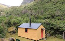
Image: DoC
Scroll down to see a topographical map and road map showing the location of Smyth Hut
[ A ] [ B ] [ C ] [ D ] [ E ] [ F ] [ G ] [ H ] [ I ] [ J ] [ K ] [ L ] [ M ] [ N ] [ O ] [ P ] [ Q ] [ R ] [ S ] [ T ] [ U ] [ V ] [ W ] [ Y ] [ Z ]
Closest 20 Huts to Smyth Hut
These are as the crow fliesCounty Stream Hut 5.65km Hunters Hut 8.08km Moonbeam Hut 8.32km Top Waitaha Hut 8.92km Ivory Lake Hut 9.71km Scamper Torrent Hut 10.92km Lyell Hut 11.17km Neave Hut 11.29km Lauper Bivouac 11.52km Kiwi Flat Hut 11.65km Reischek Hut 12.21km Price Basin Hut 12.73km Wilkinson Hut 12.83km Top Tuke Hut 13.66km Washbourne Hut 15.75km Evans Hut 15.79km Polluck Creek Hut 16.34km Lawrence Bivouac 16.63km Dickie Spur Hut 16.77km Price Flat Hut 16.92km Price Flat Hut 16.95km Healey Creek Hut 18.36km Banfield Hut 19.51km McCoy Hut 19.74km West Mathias Bivouac 20.09km Mikonui Flat Hut 20.74km Mikonui Spur Bivouac 21.21km Hermitage Hut 21.95km Cameron Hut 22.29km Thompsons Hut 22.3km Centennial Cabin 22.58km Watchdog Hut 22.68km Jellicoe Hut 22.99km Mathias Hut 23.03km Frew Hut 23.75km Lawrence Hut 23.78km Explorer Hut 23.88km Moraine Hut 23.99km Frew Saddle Bivouac 24.58km Rapid Creek Hut 25.61km