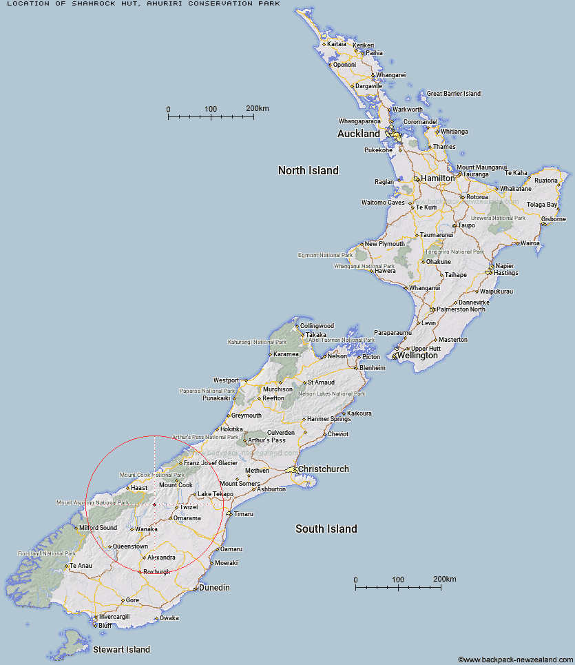
Topo Map showing location of Shamrock Hut
This information is sourced from DoC, LINZ and Openstreetmap. Some of the hut photos are mine and the rest are from DoC. I will be adding an upload feature soon so people can photos of .Shamrock Hut.
Basic info: standard two-bunk hut in the Mackenzie Country and Waitaki area.
Latitude: -44.2070431378
Longitude: 169.622873199
Location: Ahuriri Conservation Park
Area: Canterbury
Type of Hut: Standard
Tracks: Ahuriri Valley Track
Map: BZ14 Topo Map | Road Map
Does this hut still exist? Have any more information? Contact
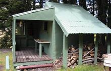
Image: DoC
Scroll down to see a topographical map and road map showing the location of Shamrock Hut
[ A ] [ B ] [ C ] [ D ] [ E ] [ F ] [ G ] [ H ] [ I ] [ J ] [ K ] [ L ] [ M ] [ N ] [ O ] [ P ] [ Q ] [ R ] [ S ] [ T ] [ U ] [ V ] [ W ] [ Y ] [ Z ]
Closest 20 Huts to Shamrock Hut
These are as the crow fliesHagens Hut 5.89km Ahuriri Base Hut 7.46km Bull Flat Hut 8.69km Scrubby Hut 9.34km Maitland Hut 9.63km Top Dingle Hut 9.75km Top Hut 10.03km Snowy Gorge Hut 10.33km Ferguson Hut 11.32km Boundary Hut 13km South Temple Hut 13.12km Green Bush Hut 13.21km Little Boundary Hut 13.7km Hideaway Hut 16.11km Ben Avon Hut 16.14km Makarora Hut 16.92km Forbes Hut 17.59km High Burn Hut 18.82km Cotters Hut 19.18km South Huxley Bivouac 20.21km Brewster Hut 21.4km Wills Hut 22.73km Main Huxley Forks Hut 24.2km Cameron Hut 24.49km Monument Hut 25.34km Bush Hut 25.83km Big Hopwood Burn Hut 26.06km Brodrick Hut 27.15km Red Hut 28.64km Mae West Bivouac 30.11km Top Timaru Hut 30.84km Creswicke Flat Hut 32.02km Le Crens Hut 32.12km Burnt Bush Hut 32.81km Dasler Bivouac 33.09km Elcho Hut 34.85km Cullers Hut 35.99km Moonlight & Roses Hut 36.48km Stony Stream Bivouac 36.7km Baikie Hut 36.94km