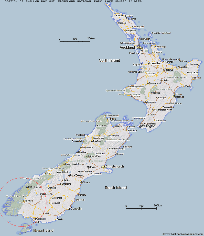
Topo Map showing location of Shallow Bay Hut
This information is sourced from DoC, LINZ and Openstreetmap. Some of the hut photos are mine and the rest are from DoC. I will be adding an upload feature soon so people can photos of .Shallow Bay Hut.
Basic info: standard six-bunk hut in eastern Fiordland.
Latitude: -45.4933980679
Longitude: 167.612515822
Location: Fiordland National Park, Lake Manapouri area
Area: Fiordland
Type of Hut: Standard
Map: CD07 Topo Map | Road Map
Does this hut still exist? Have any more information? Contact
Basic info: standard six-bunk hut in eastern Fiordland.
Latitude: -45.4933980679
Longitude: 167.612515822
Location: Fiordland National Park, Lake Manapouri area
Area: Fiordland
Type of Hut: Standard
Map: CD07 Topo Map | Road Map
Does this hut still exist? Have any more information? Contact
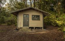
Image: DoC
Scroll down to see a topographical map and road map showing the location of Shallow Bay Hut
[ A ] [ B ] [ C ] [ D ] [ E ] [ F ] [ G ] [ H ] [ I ] [ J ] [ K ] [ L ] [ M ] [ N ] [ O ] [ P ] [ Q ] [ R ] [ S ] [ T ] [ U ] [ V ] [ W ] [ Y ] [ Z ]
Closest 20 Huts to Shallow Bay Hut
These are as the crow fliesMoturau Hut 1.31km Brod Bay Shelter and Campsite 10.98km Forest Burn Shelter 11.98km Luxmore Hut 12.03km Hope Arm Hut 12.08km Back Valley Hut 12.15km Iris Burn Hut 13.22km Hanging Valley Shelter 13.66km Freeman Burn Hut 18.98km Cheviot Downs Hut 20.48km North Borland Hut 23.56km Percy Shelter 24.89km Whare Creek Hut 25.57km West Arm Hut 27.45km Upper Princhester Hut 27.49km Lower Princhester Hut 28.65km Redcliff Hut 30.3km Spence Hut 31.4km Aparima Forks Hut 31.65km Borland Bivouac 33.21km Telford Hut 34.03km Upper Wairaki Hut 34.42km Becketts Hut 35.32km Upper Spey Hut 36.3km Green Lake Hut 36.44km Aparima Huts 38.34km Robin Saddle Hut 38.84km Junction Burn Hut 39.11km Historic Clark Hut 39.63km Clark Hut - A Frame 39.78km Oreti Hut 40.11km Kiwi Burn Hut 40.38km Lower Wairaki Hut 40.78km Kintail Hut 40.96km Army Hut 41.7km Rodger Inlet Huts 42.57km Monowai Hut 43.07km Lake Roe Hut 43.32km Rock Hut 43.78km Barcoo Hut 44.85km