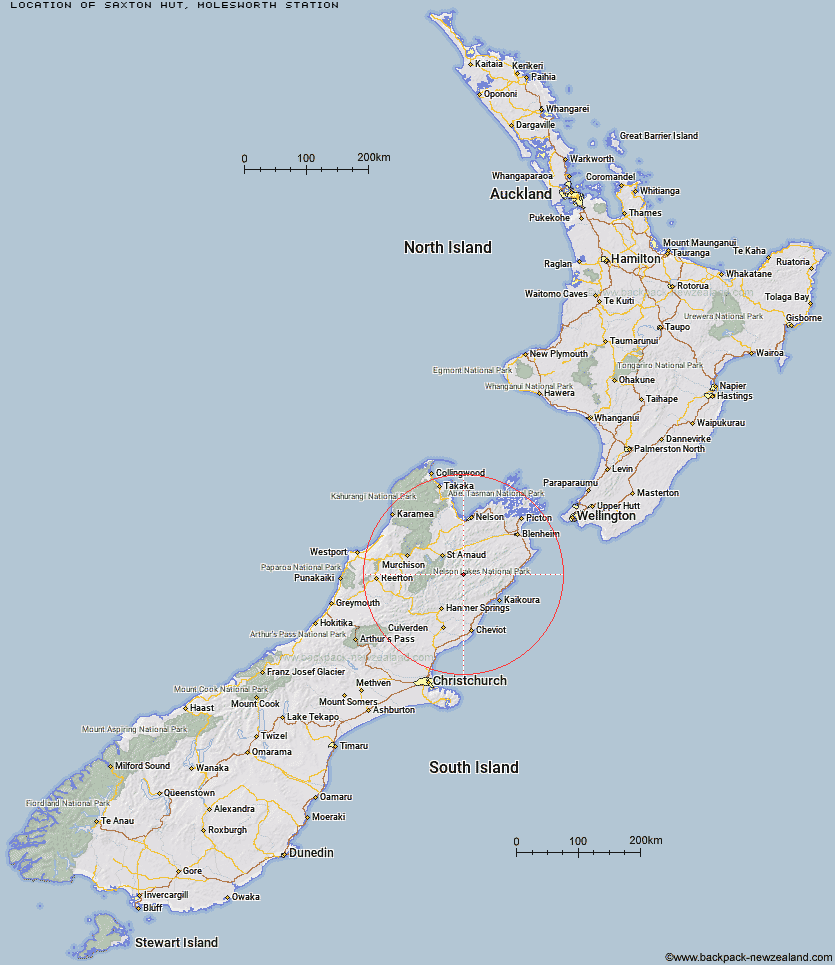
Topo Map showing location of Saxton Hut
This information is sourced from DoC, LINZ and Openstreetmap. Some of the hut photos are mine and the rest are from DoC. I will be adding an upload feature soon so people can photos of .Saxton Hut.
Basic info: standard 6-bunk hut in the South Marlborough area.
Latitude: -42.0554802261
Longitude: 173.152283761
Location: Molesworth Station
Area: Marlborough
Type of Hut: Standard
Map: BS26 Topo Map | Road Map
Does this hut still exist? Have any more information? Contact
Basic info: standard 6-bunk hut in the South Marlborough area.
Latitude: -42.0554802261
Longitude: 173.152283761
Location: Molesworth Station
Area: Marlborough
Type of Hut: Standard
Map: BS26 Topo Map | Road Map
Does this hut still exist? Have any more information? Contact
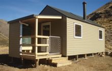
Image: DoC
Scroll down to see a topographical map and road map showing the location of Saxton Hut
[ A ] [ B ] [ C ] [ D ] [ E ] [ F ] [ G ] [ H ] [ I ] [ J ] [ K ] [ L ] [ M ] [ N ] [ O ] [ P ] [ Q ] [ R ] [ S ] [ T ] [ U ] [ V ] [ W ] [ Y ] [ Z ]
Closest 20 Huts to Saxton Hut
These are as the crow fliesCarters Yards Hut 3.61km Team Hut 4.08km Junction Hut 4.92km Acheron Hut 7.59km Munroe Hut 9.18km Severn Hut 9.56km Top Leatham Hut 10.84km Red Gate Hut 11.86km Branch Bivouac 13.96km Top Gordon Hut 14.21km Bottom Gordons Hut 14.32km Burnt Yards Hut 15.85km Bottom Misery Hut 18.13km Lees Creek Hut 19.26km Lake McRae Hut 19.82km Siberia Hut 20.61km Barbers Hut 21.39km Sedgemere Sleepout 22.65km Connors Creek Hut 22.75km Top Misery Hut 23.11km Lost Stream Bivouac 23.61km Guide Hut 24.07km Greigs Hut 24.64km Half Moon Hut 24.77km Blue Mountain Hut 25.71km Mid Silverstream Hut 27.03km Seymour Hut 27.49km Palmer Hut 27.61km Caves Hut 27.87km Bull Paddock Creek Hut 27.95km Island Gully Hut 28.75km Yarra Hut 28.95km Begley Hut 29.27km Silverstream Bivouac 30.48km Boulder Forks Hut 30.7km Old Middlehurst Hut 32.16km Palmer Bivouac 32.42km Top Whare 32.79km John Tait Hut 32.94km Black Spur Historic Hut 33.36km