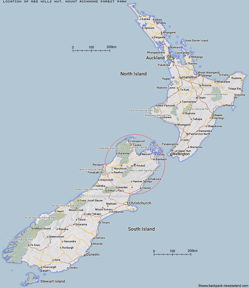
Topo Map showing location of Red Hills Hut
This information is sourced from DoC, LINZ and Openstreetmap. Some of the hut photos are mine and the rest are from DoC. I will be adding an upload feature soon so people can photos of .Red Hills Hut.
Basic info: standard 6-bunk hut in the Nelson Lakes area.
Latitude: -41.7311702327
Longitude: 172.991554833
Location: Mount Richmond Forest Park
Area: Nelson/Tasman
Type of Hut: Standard
Map: BS26 Topo Map | Road Map
Does this hut still exist? Have any more information? Contact
Basic info: standard 6-bunk hut in the Nelson Lakes area.
Latitude: -41.7311702327
Longitude: 172.991554833
Location: Mount Richmond Forest Park
Area: Nelson/Tasman
Type of Hut: Standard
Map: BS26 Topo Map | Road Map
Does this hut still exist? Have any more information? Contact
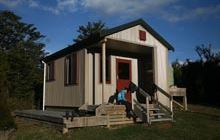
Image: DoC
Scroll down to see a topographical map and road map showing the location of Red Hills Hut
[ A ] [ B ] [ C ] [ D ] [ E ] [ F ] [ G ] [ H ] [ I ] [ J ] [ K ] [ L ] [ M ] [ N ] [ O ] [ P ] [ Q ] [ R ] [ S ] [ T ] [ U ] [ V ] [ W ] [ Y ] [ Z ]
Closest 20 Huts to Red Hills Hut
These are as the crow fliesBeebys Hut 5.19km Silverstream Bivouac 8.14km Porters Creek Hut 8.64km Bull Paddock Creek Hut 11.28km Mid Silverstream Hut 11.45km Hunters Hut 14.67km Greigs Hut 15.04km Top Wairoa Hut 15.09km Lost Stream Bivouac 15.19km Top Misery Hut 17.01km Siberia Hut 17.86km Bushline Hut 18.24km Caves Hut 18.47km Bushedge Shelter 18.69km Relax Shelter 19.03km Lower Goulter Hut 20.21km Bottom Misery Hut 20.61km Barbers Hut 20.81km Mid Wairoa Hut 20.84km Coldwater Hut 21.19km Lakehead Hut 21.34km Boulder Forks Hut 22.76km Lees Creek Hut 23.62km Speargrass Hut 23.95km Tarn Hut 24.76km Bottom Gordons Hut 24.98km Hidden Hut 25.26km Branch Bivouac 26.12km Mid Goulter Hut 26.29km Angelus Hut 26.66km Turkeys Nest Bivouac 27.46km Top Leatham Hut 27.93km Top Gordon Hut 27.97km Gosling Hut 29.4km Hopeless Hut 29.49km Mt Rintoul Hut 30.29km Blue Mountain Hut 31.2km Connors Creek Hut 31.74km Sabine Hut 31.91km Old Man Hut 32.66km