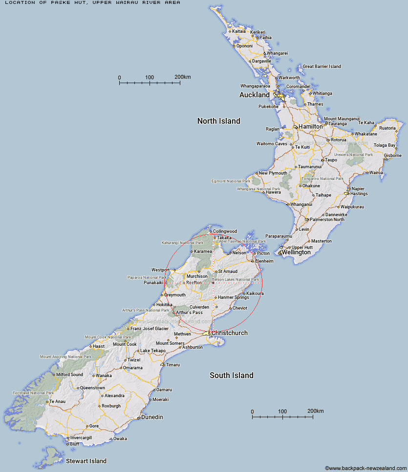
Topo Map showing location of Paske Hut
This information is sourced from DoC, LINZ and Openstreetmap. Some of the hut photos are mine and the rest are from DoC. I will be adding an upload feature soon so people can photos of .Paske Hut.
Basic info: standard 6-bunk hut in the Nelson Lakes area.
Latitude: -42.1115701515
Longitude: 172.754409016
Location: Upper Wairau River area
Area: Nelson/Tasman
Type of Hut: Standard
Map: BS24 Topo Map | Road Map
Does this hut still exist? Have any more information? Contact
Basic info: standard 6-bunk hut in the Nelson Lakes area.
Latitude: -42.1115701515
Longitude: 172.754409016
Location: Upper Wairau River area
Area: Nelson/Tasman
Type of Hut: Standard
Map: BS24 Topo Map | Road Map
Does this hut still exist? Have any more information? Contact
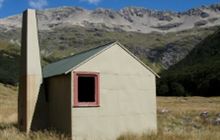
Image: DoC
Scroll down to see a topographical map and road map showing the location of Paske Hut
[ A ] [ B ] [ C ] [ D ] [ E ] [ F ] [ G ] [ H ] [ I ] [ J ] [ K ] [ L ] [ M ] [ N ] [ O ] [ P ] [ Q ] [ R ] [ S ] [ T ] [ U ] [ V ] [ W ] [ Y ] [ Z ]
Closest 20 Huts to Paske Hut
These are as the crow fliesIsland Gully Hut 7.06km Caroline Creek Bivouac 9.08km Begley Hut 9.37km Blue Lake Hut 10.11km Upper Travers Hut 10.15km Upper D'Urville Hut 12.28km Sedgemere Sleepout 12.29km West Sabine Hut 12.9km George Lyon Hut 14.23km John Tait Hut 15.26km Cupola Hut 15.63km Connors Creek Hut 16km Morgan Hut 17.59km East Matakitaki Hut 18.59km Downie Hut 19.1km Hopeless Hut 20.14km Mount Misery Hut 20.91km Lake Guyon Hut 21.38km Matakitaki Base Hut 22.13km Fowlers Hut 22.46km Mole Hut 22.49km Severn Hut 23.95km Stanley Vale Hut 24.03km Sabine Hut 24.17km D'Urville Hut 24.59km Red Gate Hut 24.72km Angelus Hut 24.82km Christopher Cullers Hut 25.03km Christopher Hut 25.1km Bobs Hut 25.38km Burn Creek Hut 25.66km Lees Creek Hut 26.11km Tiraumea Hut 26.77km Nardoo Hut 26.79km Lakehead Hut 26.82km Coldwater Hut 27.31km Yarra Hut 28.06km Branch Bivouac 28.56km Speargrass Hut 28.86km Acheron Hut 29.98km