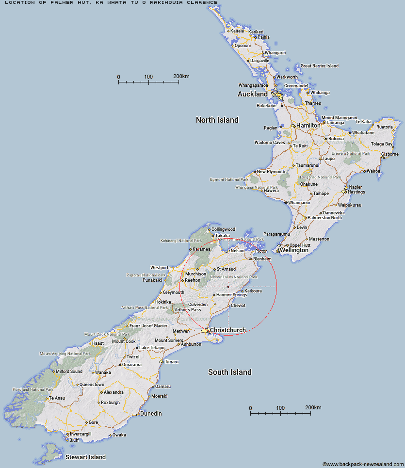
Topo Map showing location of Palmer Hut
This information is sourced from DoC, LINZ and Openstreetmap. Some of the hut photos are mine and the rest are from DoC. I will be adding an upload feature soon so people can photos of .Palmer Hut.
Basic info: standard 12-bunk hut in the South Marlborough area.
Latitude: -42.2904298392
Longitude: 173.260548219
Location: Ka Whata Tu o Rakihouia Clarence
Area: Marlborough
Type of Hut: Standard
Map: BT27 Topo Map | Road Map
Does this hut still exist? Have any more information? Contact
Basic info: standard 12-bunk hut in the South Marlborough area.
Latitude: -42.2904298392
Longitude: 173.260548219
Location: Ka Whata Tu o Rakihouia Clarence
Area: Marlborough
Type of Hut: Standard
Map: BT27 Topo Map | Road Map
Does this hut still exist? Have any more information? Contact
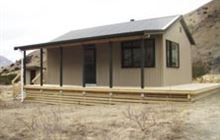
Image: DoC
Scroll down to see a topographical map and road map showing the location of Palmer Hut
[ A ] [ B ] [ C ] [ D ] [ E ] [ F ] [ G ] [ H ] [ I ] [ J ] [ K ] [ L ] [ M ] [ N ] [ O ] [ P ] [ Q ] [ R ] [ S ] [ T ] [ U ] [ V ] [ W ] [ Y ] [ Z ]
Closest 20 Huts to Palmer Hut
These are as the crow fliesPalmer Bivouac 5.15km Alfred Hut 8.2km Half Moon Hut 10.07km Lake McRae Hut 12.24km Cloudy Hut 12.28km Kahutara Bivouac 12.51km Seymour Hut 13.68km Black Spur Historic Hut 13.74km Warden Hut 14.7km Tent Poles Hut 15.04km Stone Jug Hut 15.14km Guide Hut 15.76km Limestone Hut 21.51km Yarra Hut 21.7km Acheron Hut 22.42km Red Gate Hut 24.52km Carters Yards Hut 25.36km Dubious Bivouac 26.17km Kowhai Hut 27.53km Saxton Hut 27.61km Mt Fyffe Hut 27.63km Goose Flat Hut 28.49km Junction Hut 28.89km Munroe Hut 30.24km Team Hut 30.92km Severn Hut 31.4km Hapuku Hut 32.22km Fidgit Bivouac 32.93km Barratts Hut 34.23km Barratts Bivouac 34.26km Sedgemere Sleepout 34.34km Burnt Yards Hut 36.4km Top Leatham Hut 38.23km Island Gully Hut 39.2km Ravine Hut 39.7km Top Gordon Hut 40.25km Branch Bivouac 40.74km Haycocks Bivouac 40.76km Fowlers Hut 40.84km Bottom Gordons Hut 41.63km