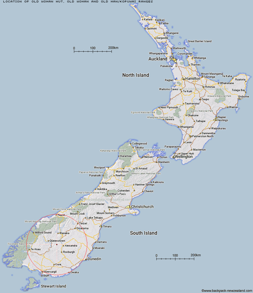
Topo Map showing location of Old Woman Hut
This information is sourced from DoC, LINZ and Openstreetmap. Some of the hut photos are mine and the rest are from DoC. I will be adding an upload feature soon so people can photos of .Old Woman Hut.
Basic info: standard six-bunk hut in the Central Otago area.
Latitude: -45.2081207749
Longitude: 169.070402287
Location: Old Woman and Old Man/Kopuwai Ranges
Area: Otago
Type of Hut: Standard
Map: CC12 Topo Map | Road Map
Does this hut still exist? Have any more information? Contact
Basic info: standard six-bunk hut in the Central Otago area.
Latitude: -45.2081207749
Longitude: 169.070402287
Location: Old Woman and Old Man/Kopuwai Ranges
Area: Otago
Type of Hut: Standard
Map: CC12 Topo Map | Road Map
Does this hut still exist? Have any more information? Contact
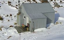
Image: DoC
Scroll down to see a topographical map and road map showing the location of Old Woman Hut
[ A ] [ B ] [ C ] [ D ] [ E ] [ F ] [ G ] [ H ] [ I ] [ J ] [ K ] [ L ] [ M ] [ N ] [ O ] [ P ] [ Q ] [ R ] [ S ] [ T ] [ U ] [ V ] [ W ] [ Y ] [ Z ]
Closest 20 Huts to Old Woman Hut
These are as the crow fliesWhites Hut 8.01km Boundary Hut 14.75km Baileys Hut 16.83km Cairnmuir Musterer's Hut 17.21km Nicholsons Hut 18.48km Diggers Hut 19.73km Glen Roy Raceman's Hut 20.38km McCrimmons Hut 20.59km Two Mile Hut 21.31km Andrew Rees Hut 24.78km Potters Huts 25.01km Deep Creek Hut 28.19km Bush Huts 30.96km Christies Hut 31.9km Blue Lake Huts 31.92km Meg Hut 32.49km Long Burn Hut 34.02km Junction Hut 34.79km Mitchells Hut 36.37km Siberia Hut 36.75km Garston Ski Hut 37.18km Ross Hut 37.97km Kirtle Burn Hut 38.15km Titan Huts 38.19km Slate Hut 38.38km Eight Mile Hut 39.93km Robrosa Hut 40.13km Mud Hut 40.21km Junction Hut 41.39km Flaxy Hut 42.7km Dome Hut 43.76km Billy Hut 45.19km Black Hut 45.2km Saint Marys Hut 45.21km Green Gate Huts 45.48km Sam Summers Hut 45.89km Butchers Hut 47.22km Stronach Hut 47.53km Roses Hut 47.76km Highland Creek Hut 49.3km