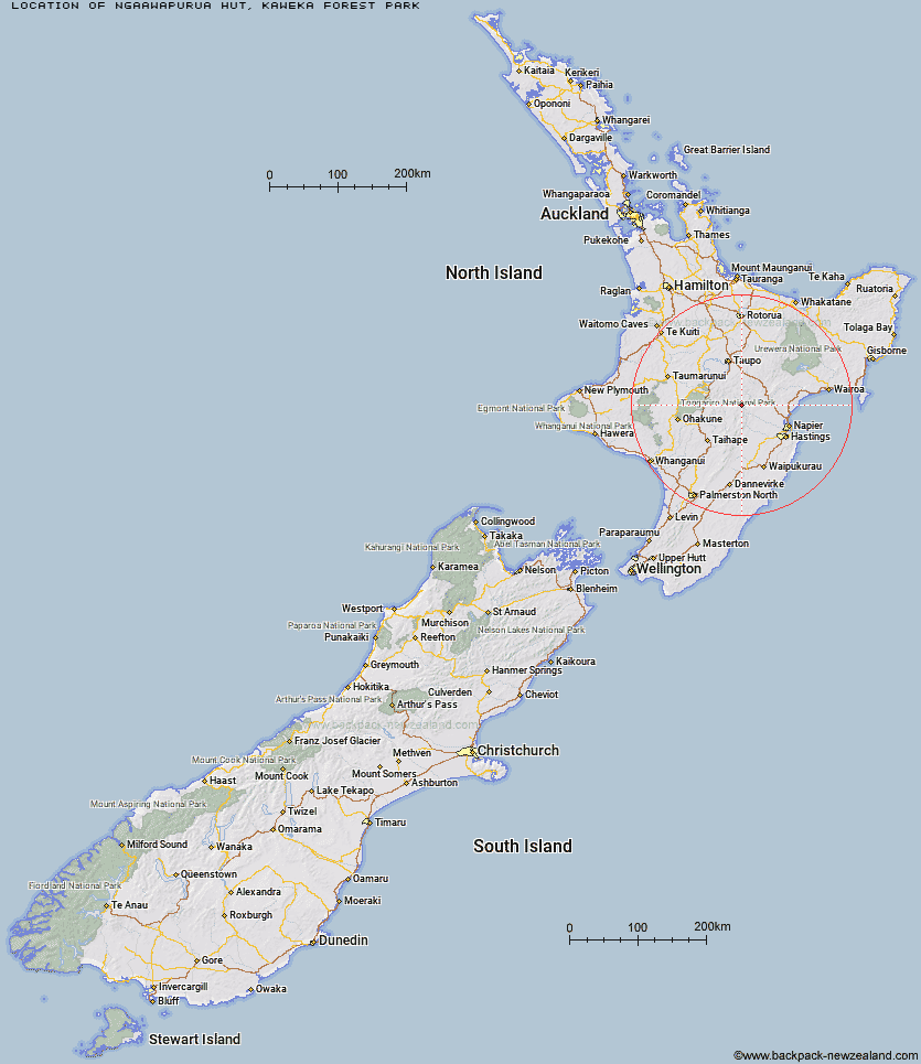
Topo Map showing location of Ngaawapurua Hut
This information is sourced from DoC, LINZ and Openstreetmap. Some of the hut photos are mine and the rest are from DoC. I will be adding an upload feature soon so people can photos of .Ngaawapurua Hut.
Basic info: At 800 metres altitude, this hut is situated on a terrace above the Ngaawapurua Stream in a sunny, flat, sheltered position.
Latitude: -39.2341682946
Longitude: 176.249043622
Location: Kaweka Forest Park
Area: Hawke's Bay
Type of Hut: Standard
Map: BJ37 Topo Map | Road Map
Does this hut still exist? Have any more information? Contact
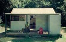
Image: DoC
Scroll down to see a topographical map and road map showing the location of Ngaawapurua Hut
[ A ] [ B ] [ C ] [ D ] [ E ] [ F ] [ G ] [ H ] [ I ] [ J ] [ K ] [ L ] [ M ] [ N ] [ O ] [ P ] [ Q ] [ R ] [ S ] [ T ] [ U ] [ V ] [ W ] [ Y ] [ Z ]
Closest 20 Huts to Ngaawapurua Hut
These are as the crow fliesOmarukokere Bivouac 4.09km Harkness Hut 4.39km Otutu Hut 4.6km Otutu Island Hut 4.99km Te Puke (Te Pukeohikarua) Hut 5.11km Rocks Ahead Bivouac 6.1km Rocks Ahead Hut 6.17km Venison Tops Hut (Tira Lodge) 6.42km Manson Hut 6.96km Old Manson Hut 7.09km Mangaturutu Hut 7.16km Manson Bivouac 7.79km Golden Hills Hut 8.12km Tussock Hut 8.16km Back Ridge Bivouac 9.37km Back Ridge Hut 10.39km Ballard Hut 10.4km Kiwi Mouth Hut 10.49km Mangatainoka Hut 10.64km Rock Camp Bivouac 11.7km Studholme Saddle Hut 12.4km Kiwi Saddle Hut 12.61km Studholme Saddle Bivouac 12.66km Dominie Hut 13.5km Te Apunga Hut 14.45km Makino Hut 14.53km Cameron Hut 14.66km Kaweka Flats Bivouac 14.77km Makahu Saddle Hut 14.87km Middle Hill Hut 15.31km WTFRW Hut 15.73km Iron Whare 15.83km East Creek Hut 16.57km Mackintosh Hut 16.7km Oamaru Hut 17.7km Black Birch Bivouac 17.94km Poronui Hut 18.19km Red Hut 18.39km Te Matai Hut 19.11km Tevers Hut 19.39km