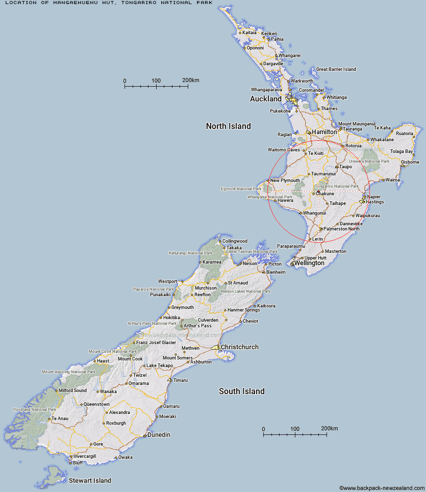
Topo Map showing location of Mangaehuehu Hut
This information is sourced from DoC, LINZ and Openstreetmap. Some of the hut photos are mine and the rest are from DoC. I will be adding an upload feature soon so people can photos of .Mangaehuehu Hut.
Basic info: serviced 18-bunk hut in the Ruapehu area.
Latitude: -39.3431177038
Longitude: 175.550044641
Location: Tongariro National Park
Area: Central North Island
Type of Hut: Serviced
Tracks: Round the Mountain Track
Map: BJ34 Topo Map | Road Map
Does this hut still exist? Have any more information? Contact
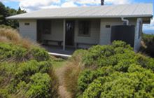
Image: DoC
Scroll down to see a topographical map and road map showing the location of Mangaehuehu Hut
[ A ] [ B ] [ C ] [ D ] [ E ] [ F ] [ G ] [ H ] [ I ] [ J ] [ K ] [ L ] [ M ] [ N ] [ O ] [ P ] [ Q ] [ R ] [ S ] [ T ] [ U ] [ V ] [ W ] [ Y ] [ Z ]
Closest 20 Huts to Mangaehuehu Hut
These are as the crow fliesBlyth Hut 2.49km Lupton Hut 2.66km Mangaturuturu Hut 6.6km Whangaehu Hut 7.51km Rangipo Hut 7.95km Whakapapaiti Hut 12.05km Old Waihohonu Hut 18.24km Waihohonu Hut 18.59km Mangatepopo Hut 22.43km Oturere Hut 23.75km Ketetahi Shelter 27.61km Zekes Hut 27.73km Westlawn Hut 29.02km Bob's Hut 37.32km Ten Man Hut 37.35km Waipakihi Hut 42.78km Te Apunga Hut 47.29km Tieke Kainga 47.9km Puketotara Hut 49.32km Golden Hills Hut 53.97km Ohuraiti Hut 54.48km Ngapurua Hut 55.25km WTFRW Hut 55.28km Downes hut 55.72km Cedars Hut (Blowfly) 56.01km John Coull Hut 56.12km Otutu Island Hut 57.69km Cascade Hut 57.96km Rock Camp Bivouac 58.82km Otutu Hut 59.26km Iron Bark Hut 59.86km Makirikiri Hut 59.87km Pouri Hut 60.1km Tussock Hut 60.59km Otukota Hut 61.01km Manson Hut 61.29km Ngaawapurua Hut 61.36km Old Manson Hut 61.54km Harkness Hut 61.55km Ikawetea Forks Hut 61.99km