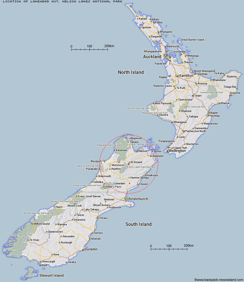
Topo Map showing location of Lakehead Hut
This information is sourced from DoC, LINZ and Openstreetmap. Some of the hut photos are mine and the rest are from DoC. I will be adding an upload feature soon so people can photos of .Lakehead Hut.
Basic info: Lakehead Hut makes a good overnight tramp for families with children or new trampers. It can also be reached by water taxi.
Latitude: -41.8756426378
Longitude: 172.822074559
Location: Nelson Lakes National Park
Area: Nelson/Tasman
Type of Hut: Serviced
Tracks: Lake Rotoiti Circuit|Travers-Sabine Circuit
Map: BS24 Topo Map | Road Map
Does this hut still exist? Have any more information? Contact
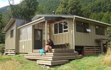
Image: DoC
Scroll down to see a topographical map and road map showing the location of Lakehead Hut
[ A ] [ B ] [ C ] [ D ] [ E ] [ F ] [ G ] [ H ] [ I ] [ J ] [ K ] [ L ] [ M ] [ N ] [ O ] [ P ] [ Q ] [ R ] [ S ] [ T ] [ U ] [ V ] [ W ] [ Y ] [ Z ]
Closest 20 Huts to Lakehead Hut
These are as the crow fliesColdwater Hut 0.71km Bushline Hut 4.32km Relax Shelter 4.64km Bushedge Shelter 5km Angelus Hut 6.24km Speargrass Hut 6.34km Hopeless Hut 8.15km John Tait Hut 11.88km Sabine Hut 11.99km Cupola Hut 13km Mount Misery Hut 14.12km Top Misery Hut 14.28km Lees Creek Hut 14.7km D'Urville Hut 14.93km Bull Paddock Creek Hut 15.19km Connors Creek Hut 15.34km Lost Stream Bivouac 16.81km Upper Travers Hut 17.16km Begley Hut 17.72km West Sabine Hut 18.62km Bottom Misery Hut 19.25km Mid Silverstream Hut 19.53km Beebys Hut 19.6km Morgan Hut 19.8km Tiraumea Hut 20.21km Branch Bivouac 20.3km Silverstream Bivouac 20.37km Siberia Hut 20.94km Red Hills Hut 21.34km Mole Hut 22.77km Greigs Hut 23.85km Top Leatham Hut 24.09km Blue Lake Hut 24.55km George Lyon Hut 26.21km Paske Hut 26.82km Bottom Gordons Hut 26.87km Severn Hut 27.28km Porters Creek Hut 28.65km Barbers Hut 28.76km Matakitaki Base Hut 29.47km