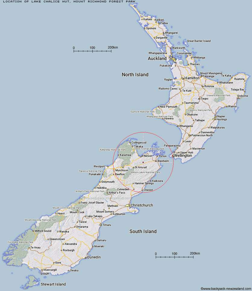
Topo Map showing location of Lake Chalice Hut
This information is sourced from DoC, LINZ and Openstreetmap. Some of the hut photos are mine and the rest are from DoC. I will be adding an upload feature soon so people can photos of .Lake Chalice Hut.
Basic info: standard 8-bunk hut in the South Marlborough area.
Latitude: -41.5678140928
Longitude: 173.320183268
Location: Mount Richmond Forest Park
Area: Marlborough
Type of Hut: Standard
Tracks: Lake Chalice Hut tracks
Map: BR26 Topo Map | Road Map
Does this hut still exist? Have any more information? Contact
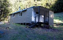
Image: DoC
Scroll down to see a topographical map and road map showing the location of Lake Chalice Hut
[ A ] [ B ] [ C ] [ D ] [ E ] [ F ] [ G ] [ H ] [ I ] [ J ] [ K ] [ L ] [ M ] [ N ] [ O ] [ P ] [ Q ] [ R ] [ S ] [ T ] [ U ] [ V ] [ W ] [ Y ] [ Z ]
Closest 20 Huts to Lake Chalice Hut
These are as the crow fliesOld Man Hut 6.31km Mid Goulter Hut 7.19km Slaty Hut 9.79km Mt Rintoul Hut 9.89km Richmond Saddle Hut 11.69km Tarn Hut 12.78km Lower Goulter Hut 12.98km Starveall Hut 13.87km Mt Fell Hut 14.56km Mid Wairoa Hut 16.54km Browning Hut 17.51km Roebuck Hut 17.6km Hacket Hut 17.99km Hidden Hut 19.23km Fishtail Hut 19.54km Turkeys Nest Bivouac 19.94km Top Wairoa Hut 20.91km Middy Creek Hut 21.29km Gosling Hut 22.41km Rocks Hut 22.49km Captain Creek Hut 23.58km Dun Shelter 25.28km Boulder Forks Hut 25.31km Hunters Hut 26.62km Third House Shelter 26.97km Devils Creek Hut 27.25km Porters Creek Hut 28.49km Caves Hut 28.65km Chimney 30.32km Fosters Hut 30.72km Top Whare 32km Blue Mountain Hut 32.79km Red Hills Hut 32.79km Silverstream Bivouac 34.14km McNaughts Hut 34.28km Mt Sunday Bivouac 34.7km Greigs Hut 34.81km Lake Alexander Hut 34.84km Barbers Hut 35.19km Beebys Hut 36.45km