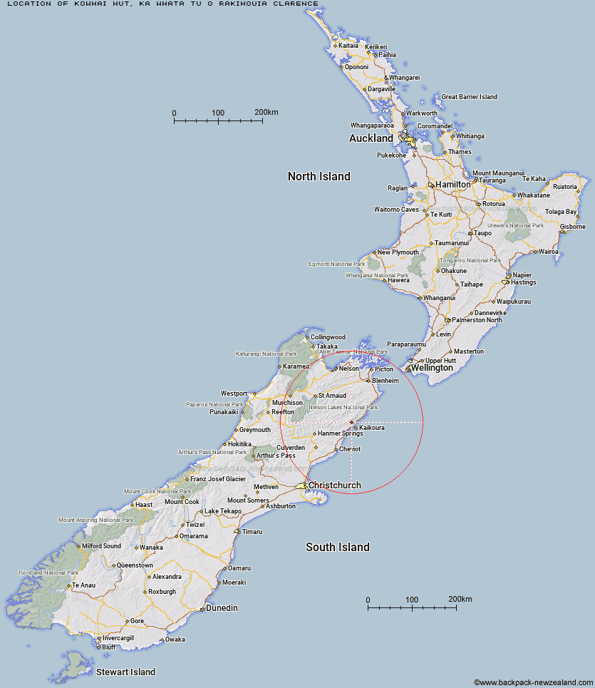
Topo Map showing location of Kowhai Hut
This information is sourced from DoC, LINZ and Openstreetmap. Some of the hut photos are mine and the rest are from DoC. I will be adding an upload feature soon so people can photos of .Kowhai Hut.
Basic info: standard 6-bunk hut in the South Marlborough area.
Latitude: -42.2983945022
Longitude: 173.595066124
Location: Ka Whata Tu o Rakihouia Clarence
Area: Marlborough
Type of Hut: Standard
Map: BT27 Topo Map | Road Map
Does this hut still exist? Have any more information? Contact
Basic info: standard 6-bunk hut in the South Marlborough area.
Latitude: -42.2983945022
Longitude: 173.595066124
Location: Ka Whata Tu o Rakihouia Clarence
Area: Marlborough
Type of Hut: Standard
Map: BT27 Topo Map | Road Map
Does this hut still exist? Have any more information? Contact
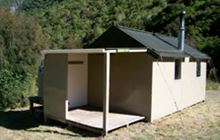
Image: DoC
Scroll down to see a topographical map and road map showing the location of Kowhai Hut
[ A ] [ B ] [ C ] [ D ] [ E ] [ F ] [ G ] [ H ] [ I ] [ J ] [ K ] [ L ] [ M ] [ N ] [ O ] [ P ] [ Q ] [ R ] [ S ] [ T ] [ U ] [ V ] [ W ] [ Y ] [ Z ]
Closest 20 Huts to Kowhai Hut
These are as the crow fliesMt Fyffe Hut 2.85km Hapuku Hut 5.46km Barratts Hut 8.7km Barratts Bivouac 8.79km Limestone Hut 8.89km Dubious Bivouac 9.44km Tent Poles Hut 12.5km Warden Hut 13.07km Fidgit Bivouac 13.83km Black Spur Historic Hut 14.09km Kahutara Bivouac 15.71km Goose Flat Hut 16.77km Seymour Hut 18.26km Alfred Hut 20.48km Haycocks Bivouac 21.45km Jam Hut 24.63km Ravine Hut 24.66km Stone Jug Hut 24.97km Lake McRae Hut 26.24km Palmer Hut 27.53km Palmer Bivouac 28.15km Hornby Bivvy 28.59km Snowgrass Hut 29.88km Dee Hut 35.59km Cloudy Hut 36.24km Gibson Hut 36.99km Old Middlehurst Hut 37.26km Half Moon Hut 37.56km Cabbage Tree Hut 39.83km Mead Hut 40.29km Carters Yards Hut 41.9km Munroe Hut 42.06km Guide Hut 43.17km Junction Hut 43.6km Acheron Hut 44.1km Cam Hut 44.23km Burnt Yards Hut 44.4km Saxton Hut 45.4km Team Hut 46.77km Flynns 47km