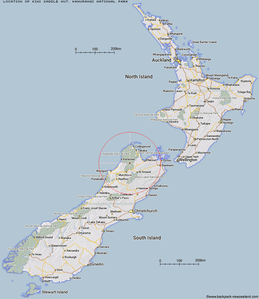
Topo Map showing location of Kiwi Saddle Hut
This information is sourced from DoC, LINZ and Openstreetmap. Some of the hut photos are mine and the rest are from DoC. I will be adding an upload feature soon so people can photos of .Kiwi Saddle Hut.
Basic info: standard 6-bunk hut in the Motueka area.
Latitude: -41.4070522381
Longitude: 172.494574573
Location: Kahurangi National Park
Area: Nelson/Tasman
Type of Hut: Standard
Map: BQ23 Topo Map | Road Map
Does this hut still exist? Have any more information? Contact
Basic info: standard 6-bunk hut in the Motueka area.
Latitude: -41.4070522381
Longitude: 172.494574573
Location: Kahurangi National Park
Area: Nelson/Tasman
Type of Hut: Standard
Map: BQ23 Topo Map | Road Map
Does this hut still exist? Have any more information? Contact
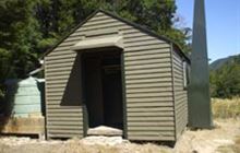
Image: DoC
Scroll down to see a topographical map and road map showing the location of Kiwi Saddle Hut
[ A ] [ B ] [ C ] [ D ] [ E ] [ F ] [ G ] [ H ] [ I ] [ J ] [ K ] [ L ] [ M ] [ N ] [ O ] [ P ] [ Q ] [ R ] [ S ] [ T ] [ U ] [ V ] [ W ] [ Y ] [ Z ]
Closest 20 Huts to Kiwi Saddle Hut
These are as the crow fliesJohn Reid Hut 4.62km Stone Hut 4.84km Kings Creek Hut 6.59km Cecil Kings Hut 6.78km Thor Hut 7.66km Trevor Carter Hut 8.75km Venus Hut 11.03km Helicopter Flat Hut 11.18km Crow Hut 12.82km Branch Creek Hut 13.06km Granity Pass Hut 14.04km Hurricane Hut 14.49km Taipo Hut 15.12km Stag Flat Shelter 16.64km Flanagans Hut 17.07km Kākāpō Hut 17.96km Wangapeka Bivouac 18.41km Karamea Bend Hut 19.39km Johnson Hut 19.41km Belltown Manunui Hut 22.42km Larrikin Creek Hut 22.58km McConchies Hut 22.81km Roaring Lion Hut 23.8km Splugeons Rock Shelter 24.37km Ellis Hut 24.68km Greys Hut 26.13km Poor Pete's Hut 27.13km Balloon Hut 28.53km Dry Rock Shelter 29.01km Mt Arthur Hut 29.71km Mokihinui Forks Hut 30.65km Growler Rock Shelter 30.65km Lake Matiri Hut 30.88km Upper Gridiron Hut and Rock Shelters 31.24km Flora Hut 31.77km Myttons Hut 31.98km Trilobite Hut 32.23km Specimen Point Hut 32.37km Goat Creek Hut 33.1km Adams Flat Hut 33.13km