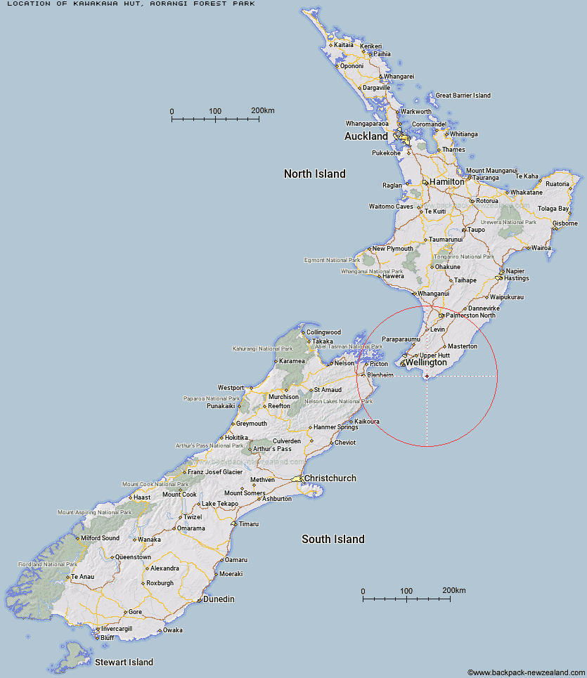
Topo Map showing location of Kawakawa Hut
This information is sourced from DoC, LINZ and Openstreetmap. Some of the hut photos are mine and the rest are from DoC. I will be adding an upload feature soon so people can photos of .Kawakawa Hut.
Basic info: standard six-bunk hut in the Wairarapa region.
Latitude: -41.5307459302
Longitude: 175.293438037
Location: Aorangi Forest Park
Area: Wairarapa
Type of Hut: Standard
Tracks: Aorangi Crossing
Map: BQ33 Topo Map | Road Map
Does this hut still exist? Have any more information? Contact
Basic info: standard six-bunk hut in the Wairarapa region.
Latitude: -41.5307459302
Longitude: 175.293438037
Location: Aorangi Forest Park
Area: Wairarapa
Type of Hut: Standard
Tracks: Aorangi Crossing
Map: BQ33 Topo Map | Road Map
Does this hut still exist? Have any more information? Contact
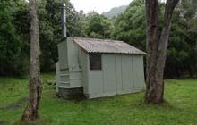
Image: DoC
Scroll down to see a topographical map and road map showing the location of Kawakawa Hut
[ A ] [ B ] [ C ] [ D ] [ E ] [ F ] [ G ] [ H ] [ I ] [ J ] [ K ] [ L ] [ M ] [ N ] [ O ] [ P ] [ Q ] [ R ] [ S ] [ T ] [ U ] [ V ] [ W ] [ Y ] [ Z ]
Closest 20 Huts to Kawakawa Hut
These are as the crow fliesPararaki Hut 3.23km Mangatoetoe Hut 4.73km Washpool Hut 5.96km Sutherlands Hut 10.94km Tauanui Hut 15.93km Wharepapa Hut 29.24km Barneys Whare 31.7km Papatahi Hut 32.4km Haurangi Hut 33.41km Jans Hut 33.41km Waerenga Hut 33.67km Boar Inn 33.96km Paua Hut 34.02km Waiorongomai Hut 34.24km Smith Creek Shelter 53.01km Eastern Hutt Hut 57.31km Tutuwai Hut 57.95km Waiohine Shelter 58.74km Cone Hut 60.59km Alpha Hut 60.61km Elder Hut 62.35km Renata Hut 63.35km Kime Hut 65.4km Sayer Hut 65.51km Waiotauru Hut 66.41km Neill Forks Hut 66.7km Totara Flats Hut 67.13km Maungahuka Hut 68.86km Kapakapanui Hut 69.22km Field Hut 69.34km Penn Creek Hut 69.97km Aokaparangi Hut 71.26km Mountain House Shelter 71.68km Powell Hut 72.65km Mid Waiohine Hut 73.4km Atiwhakatu Hut 74.89km Jumbo Hut 76.2km Anderson Memorial Hut 76.27km Waitewaewae Hut 77.82km McGregor Bivouac 78.24km