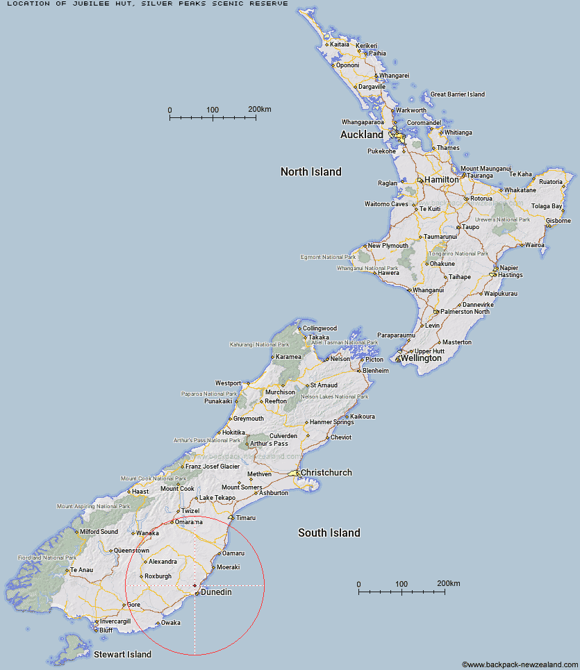
Topo Map showing location of Jubilee Hut
This information is sourced from DoC, LINZ and Openstreetmap. Some of the hut photos are mine and the rest are from DoC. I will be adding an upload feature soon so people can photos of .Jubilee Hut.
Basic info: standard ten-bunk hut in the Coastal Otago area.
Latitude: -45.7190340077
Longitude: 170.440252952
Location: Silver Peaks Scenic Reserve
Area: Otago
Type of Hut: Standard
Tracks: Silver Peaks routes
Map: CE17 Topo Map | Road Map
Does this hut still exist? Have any more information? Contact
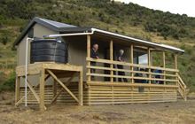
Image: DoC
Scroll down to see a topographical map and road map showing the location of Jubilee Hut
[ A ] [ B ] [ C ] [ D ] [ E ] [ F ] [ G ] [ H ] [ I ] [ J ] [ K ] [ L ] [ M ] [ N ] [ O ] [ P ] [ Q ] [ R ] [ S ] [ T ] [ U ] [ V ] [ W ] [ Y ] [ Z ]
Closest 20 Huts to Jubilee Hut
These are as the crow fliesChristmas Creek Hut 1.54km Mt John Hut 2.4km Possum Hut 4.43km Philip J Cox Memorial Hut 4.5km Bendoran Hut 6km Poplar Hut 6.03km Ben Rudds Hut 12.08km Big Hut 42.41km Leaning Lodge 43.2km Howells Hut 44.11km Tent Hut 44.35km The Swamp Hut 49.36km Staircase Hut 50.9km Iron Hut 53.07km Red Hut 54.45km Canadian Hut 56.03km Gentle Annie Hut 56.3km Bog Hut 58.34km Cayenne Hut 58.53km Grays Hut 61.84km Mitchells Hut 62.67km Mount Hut 64.58km Half Moon Hut 64.61km Crumb Hut 68.81km Middle Hut 71.82km Balmoral Huts 78.1km Buster Hut 89.7km Brown Hut 93.37km Tailings Hut 97.22km Hut Creek Hut 99.29km Ida Railway Hut 99.34km Wire Yards Hut 99.94km Junction Hut 100.42km Chimney Creek Hut 102.37km Waitaki Huts 103.39km Beaumont Hut 104.89km Awakino Ski Field 105.15km Nicholsons Hut 105.82km Potters Huts 105.97km Andrew Rees Hut 106.4km