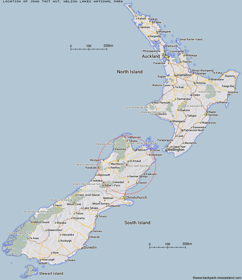
Topo Map showing location of John Tait Hut
This information is sourced from DoC, LINZ and Openstreetmap. Some of the hut photos are mine and the rest are from DoC. I will be adding an upload feature soon so people can photos of .John Tait Hut.
Basic info: serviced 27-bunk hut in the Nelson Lakes area.
Latitude: -41.9747641317
Longitude: 172.768641115
Location: Nelson Lakes National Park
Area: Nelson/Tasman
Type of Hut: Serviced
Tracks: Travers-Sabine Circuit
Map: BS24 Topo Map | Road Map
Does this hut still exist? Have any more information? Contact
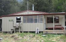
Image: DoC
Scroll down to see a topographical map and road map showing the location of John Tait Hut
[ A ] [ B ] [ C ] [ D ] [ E ] [ F ] [ G ] [ H ] [ I ] [ J ] [ K ] [ L ] [ M ] [ N ] [ O ] [ P ] [ Q ] [ R ] [ S ] [ T ] [ U ] [ V ] [ W ] [ Y ] [ Z ]
Closest 20 Huts to John Tait Hut
These are as the crow fliesCupola Hut 2.98km Hopeless Hut 5.03km Upper Travers Hut 5.3km Begley Hut 7.06km West Sabine Hut 7.9km Mount Misery Hut 9.28km Angelus Hut 9.74km Connors Creek Hut 10.22km Sabine Hut 10.92km Morgan Hut 11.43km Lakehead Hut 11.88km Coldwater Hut 12.27km D'Urville Hut 12.71km Blue Lake Hut 13.2km Speargrass Hut 13.71km Paske Hut 15.26km George Lyon Hut 15.74km Relax Shelter 15.9km Bushline Hut 16km Bushedge Shelter 16.3km Mole Hut 16.32km Tiraumea Hut 17.15km Lees Creek Hut 17.4km Island Gully Hut 19.66km Upper D'Urville Hut 20.04km Sedgemere Sleepout 20.9km Matakitaki Base Hut 21.08km Top Misery Hut 21.21km Caroline Creek Bivouac 21.81km Branch Bivouac 22.23km Severn Hut 24.18km Bottom Misery Hut 24.28km Lost Stream Bivouac 24.42km Bull Paddock Creek Hut 24.59km Top Leatham Hut 25.91km Downie Hut 26.76km Siberia Hut 27.48km Mid Silverstream Hut 28.48km Red Gate Hut 29.29km East Matakitaki Hut 29.9km