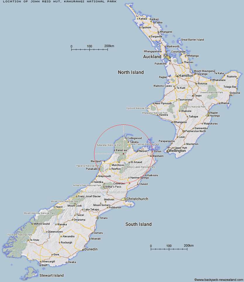
Topo Map showing location of John Reid Hut
This information is sourced from DoC, LINZ and Openstreetmap. Some of the hut photos are mine and the rest are from DoC. I will be adding an upload feature soon so people can photos of .John Reid Hut.
Basic info: standard 6-bunk hut in the Motueka area.
Latitude: -41.4021779622
Longitude: 172.549597429
Location: Kahurangi National Park
Area: Nelson/Tasman
Type of Hut: Standard
Map: BQ23 Topo Map | Road Map
Does this hut still exist? Have any more information? Contact
Basic info: standard 6-bunk hut in the Motueka area.
Latitude: -41.4021779622
Longitude: 172.549597429
Location: Kahurangi National Park
Area: Nelson/Tasman
Type of Hut: Standard
Map: BQ23 Topo Map | Road Map
Does this hut still exist? Have any more information? Contact
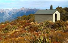
Image: DoC
Scroll down to see a topographical map and road map showing the location of John Reid Hut
[ A ] [ B ] [ C ] [ D ] [ E ] [ F ] [ G ] [ H ] [ I ] [ J ] [ K ] [ L ] [ M ] [ N ] [ O ] [ P ] [ Q ] [ R ] [ S ] [ T ] [ U ] [ V ] [ W ] [ Y ] [ Z ]
Closest 20 Huts to John Reid Hut
These are as the crow fliesKiwi Saddle Hut 4.62km Kings Creek Hut 9.05km Cecil Kings Hut 9.28km Stone Hut 9.42km Thor Hut 10.81km Venus Hut 13.21km Trevor Carter Hut 13.29km Granity Pass Hut 13.47km Crow Hut 13.85km Branch Creek Hut 13.91km Flanagans Hut 14.91km Helicopter Flat Hut 15.8km Hurricane Hut 18.14km Karamea Bend Hut 19.08km Taipo Hut 19.68km Stag Flat Shelter 21.2km Ellis Hut 21.53km Kākāpō Hut 21.94km Splugeons Rock Shelter 22.44km Wangapeka Bivouac 22.88km Johnson Hut 23.92km Roaring Lion Hut 24.69km McConchies Hut 25.74km Larrikin Creek Hut 26.19km Dry Rock Shelter 26.62km Balloon Hut 26.62km Mt Arthur Hut 26.63km Belltown Manunui Hut 26.73km Growler Rock Shelter 28.17km Upper Gridiron Hut and Rock Shelters 28.53km Flora Hut 28.69km Greys Hut 29.19km Poor Pete's Hut 30.23km Myttons Hut 30.23km Trilobite Hut 30.64km Asbestos Cottage 32.55km Lake Matiri Hut 33.62km Sylvester Hut 33.87km Chaffey Hut 34.22km Mokihinui Forks Hut 34.91km