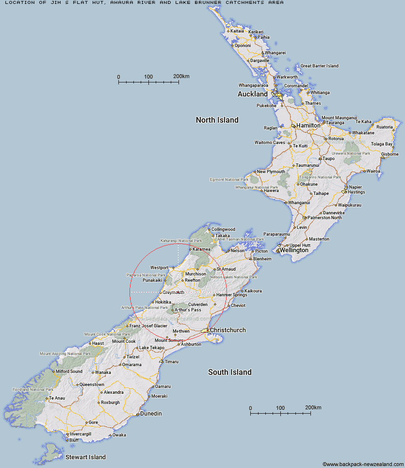
Topo Map showing location of Jim's Flat Hut
This information is sourced from DoC, LINZ and Openstreetmap. Some of the hut photos are mine and the rest are from DoC. I will be adding an upload feature soon so people can photos of .Jim's Flat Hut.
Basic info: basic four-bunk hut in the Greymouth area.
Latitude: -42.4345454667
Longitude: 171.730474275
Location: Ahaura River and Lake Brunner catchments area
Area: West Coast
Type of Hut: Basic/bivvies
Map: BT20 Topo Map | Road Map
Does this hut still exist? Have any more information? Contact
Basic info: basic four-bunk hut in the Greymouth area.
Latitude: -42.4345454667
Longitude: 171.730474275
Location: Ahaura River and Lake Brunner catchments area
Area: West Coast
Type of Hut: Basic/bivvies
Map: BT20 Topo Map | Road Map
Does this hut still exist? Have any more information? Contact
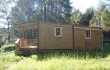
Image: DoC
Scroll down to see a topographical map and road map showing the location of Jim's Flat Hut
[ A ] [ B ] [ C ] [ D ] [ E ] [ F ] [ G ] [ H ] [ I ] [ J ] [ K ] [ L ] [ M ] [ N ] [ O ] [ P ] [ Q ] [ R ] [ S ] [ T ] [ U ] [ V ] [ W ] [ Y ] [ Z ]
Closest 20 Huts to Jim's Flat Hut
These are as the crow fliesWaikiti Hut 22.42km Big River Hut 24.99km Lake Morgan Hut 25.5km Cone Creek Hut 27.56km Tutaekuri Hut 28.11km Elizabeth Hut 28.56km Mid Robinson Hut 29.9km Top Crooked Hut 30.18km Top Trent / Lagoon Hut 30.66km Garden Gully Hut 31.05km Mid Trent Hut 31.38km Jacko Flat Hut 31.48km Slaty Creek Hut 31.54km Ces Clark Hut 31.89km Croesus Top Hut 31.93km Meikles Hut 32.87km Camp Creek Hut 33.21km Mackenzie Hut 33.49km Locke Stream Hut 34.92km Harper Pass Bivouac 35.05km Camerons Hut 35.68km Kiwi Hut 35.86km Mackenzie Bivouac 36.32km Hurunui No 3 Hut 36.35km Top Robinson Hut 37.14km Townsend Hut 37.97km Montgomerie Hut 38.55km Lake Stream Hut 39.01km Top Waitahu Bivouac 40.23km Top Hope Hut 40.35km Minchin Bivouac 40.58km Pfeifer Bivouac 41.35km Doubtless Hut 41.79km Koropuku Hut 41.97km Carroll Hut 42.19km Upper South Branch Hurunui Hut 42.22km Hurunui Hut 42.34km Poulter Bivouac 42.46km Lake Man Bivouac 42.5km Three Mile Stream Hut 42.72km