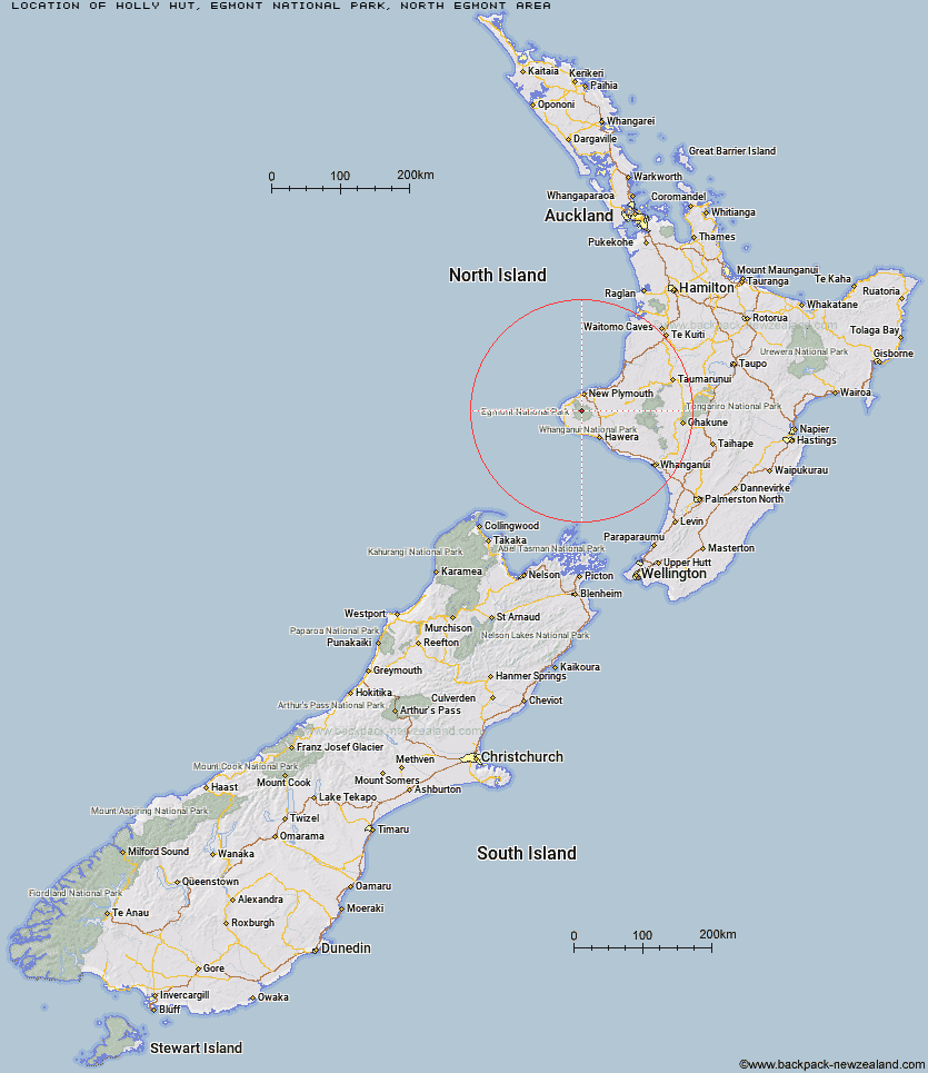
Topo Map showing location of Holly Hut
This information is sourced from DoC, LINZ and Openstreetmap. Some of the hut photos are mine and the rest are from DoC. I will be adding an upload feature soon so people can photos of .Holly Hut.
Basic info: This 32-bunk serviced hut is a gateway to some of Egmont National Park's most spectacular features.
Latitude: -39.2649277263
Longitude: 174.047515779
Location: Egmont National Park, North Egmont area
Area: Taranaki
Type of Hut: Serviced
Tracks: Around the Mountain Circuit|Pouakai Circuit|North Egmont tramping tracks
Map: BJ29 Topo Map | Road Map
Does this hut still exist? Have any more information? Contact
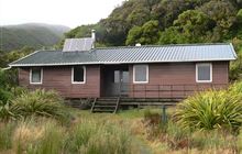
Image: DoC
Scroll down to see a topographical map and road map showing the location of Holly Hut
[ A ] [ B ] [ C ] [ D ] [ E ] [ F ] [ G ] [ H ] [ I ] [ J ] [ K ] [ L ] [ M ] [ N ] [ O ] [ P ] [ Q ] [ R ] [ S ] [ T ] [ U ] [ V ] [ W ] [ Y ] [ Z ]
Closest 20 Huts to Holly Hut
These are as the crow fliesPouakai Hut 3.42km Kaiauai Shelter 4.29km Kahui Hut 4.31km Maketawa Hut 4.81km Syme Hut 5.19km Hooker Shelter 6.8km Waiaua Gorge Hut 7.69km Lake Dive Hut 8km Waingongoro Hut 8.07km Waiweranui Trust Hut 9.69km Omaru Hut 62.89km Trains Hut 63.34km Puteore Hut 64.89km Tahupo Hut 65.24km Rerekapa Hut 68.77km Pouri Hut 69.62km John Coull Hut 74.65km Ngapurua Hut 74.99km Puketotara Hut 80.49km Tieke Kainga 81.77km Ohuraiti Hut 88.48km Downes hut 106.22km Leitchs Hut 112.18km Ten Man Hut 123.87km Mangaturuturu Hut 125.22km Whakapapaiti Hut 126.62km Lupton Hut 127.12km Blyth Hut 127.36km Mangaehuehu Hut 129.57km Whangaehu Hut 132.67km Mangatepopo Hut 134.15km Rangipo Hut 135.73km Hauhungaroa Hut 139.39km Ketetahi Shelter 139.46km Old Waihohonu Hut 140.1km Waihohonu Hut 140.72km Oturere Hut 141.93km Hamilton Tomo Group Hut 144.31km Waihaha Hut 148.46km Zekes Hut 149.2km