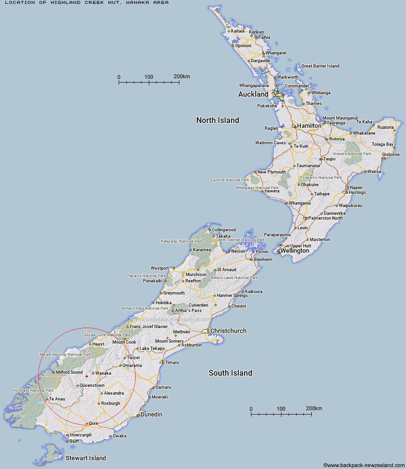
Topo Map showing location of Highland Creek Hut
This information is sourced from DoC, LINZ and Openstreetmap. Some of the hut photos are mine and the rest are from DoC. I will be adding an upload feature soon so people can photos of .Highland Creek Hut.
Basic info: standard 12-bunk hut in the Wanaka/Makarora area.
Latitude: -44.7741674216
Longitude: 168.941782732
Location: Wanaka area
Area: Otago
Type of Hut: Standard
Tracks: Motatapu Track
Map: CB12 Topo Map | Road Map
Does this hut still exist? Have any more information? Contact
Basic info: standard 12-bunk hut in the Wanaka/Makarora area.
Latitude: -44.7741674216
Longitude: 168.941782732
Location: Wanaka area
Area: Otago
Type of Hut: Standard
Tracks: Motatapu Track
Map: CB12 Topo Map | Road Map
Does this hut still exist? Have any more information? Contact
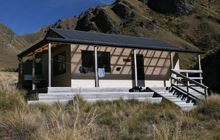
Image: DoC
Scroll down to see a topographical map and road map showing the location of Highland Creek Hut
[ A ] [ B ] [ C ] [ D ] [ E ] [ F ] [ G ] [ H ] [ I ] [ J ] [ K ] [ L ] [ M ] [ N ] [ O ] [ P ] [ Q ] [ R ] [ S ] [ T ] [ U ] [ V ] [ W ] [ Y ] [ Z ]
Closest 20 Huts to Highland Creek Hut
These are as the crow fliesFern Burn Hut 5.09km Roses Hut 7.09km Eight Mile Hut 14.95km Cabin Hut 15.52km Saddle Hut 16.09km Meg Hut 18.18km Polnoon Hut 18.42km Peats Hut 18.52km Shiel Burn Hut 19.3km Kirtle Burn Hut 20.35km Bullendale Hut 21.23km Robrosa Hut 21.56km Black Peak Hut 21.57km Dynamo Hut 22.25km Crystal Hut 22.53km Sainsburys Huts 22.63km Ballarat Hut - Flood Burn 22.64km Green Gate Huts 24.11km Archie's Hut - Copper Creek 24.16km Deep Creek Hut 24.75km Sixteen Mile Huts 25.64km Hundred Mile Hut 28.96km Stoney Creek Hut 29.15km Butchers Hut 30.56km Wanaka Faces Hut 31.19km Tummel Burn Hut 31.39km Lochnagar Hut 32.28km Raspberry Creek Shelter 32.85km Glen Roy Raceman's Hut 35.11km Wallers Hut 37.16km Kelly's Hut 37.6km Cascade Hut 38.04km McIntosh Hut 38.82km Pakituhi Hut 39.13km Heather Jock Hut 39.36km Aspiring Hut 39.84km McIntyre's Hut 39.87km Bonnie Jean Hut 39.98km Jean Hut 40.1km Twenty Five Mile Hut 40.1km