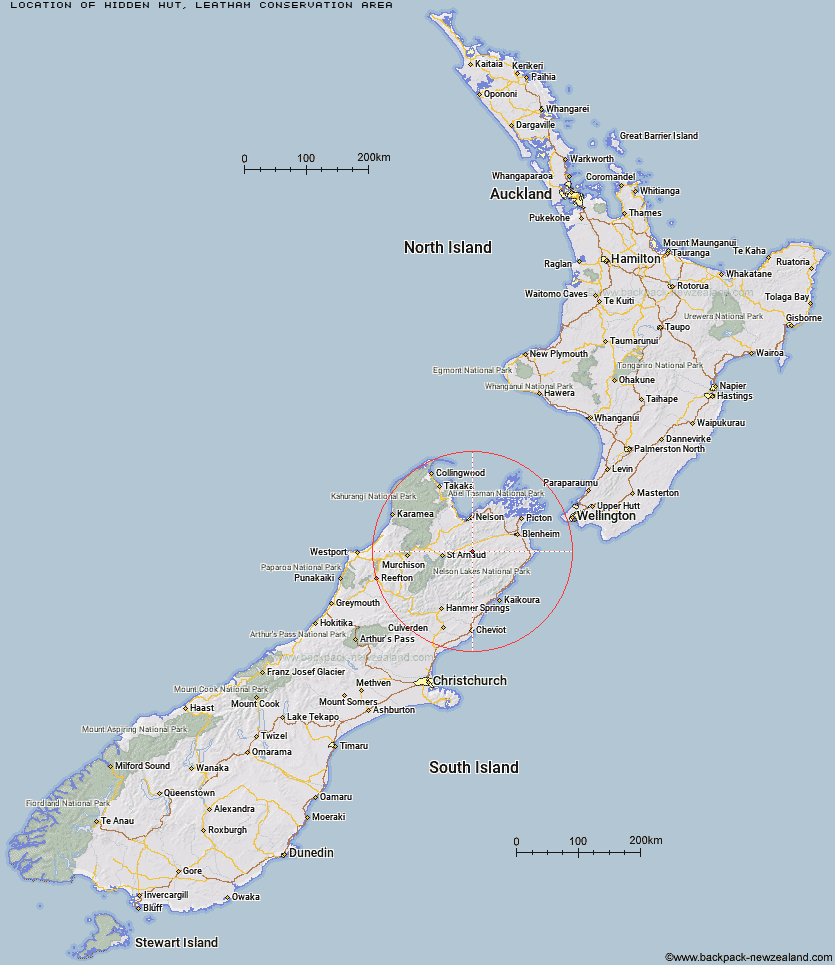
Topo Map showing location of Hidden Hut
This information is sourced from DoC, LINZ and Openstreetmap. Some of the hut photos are mine and the rest are from DoC. I will be adding an upload feature soon so people can photos of .Hidden Hut.
Basic info: standard 4-bunk hut in the South Marlborough area.
Latitude: -41.7397497445
Longitude: 173.295812988
Location: Leatham Conservation Area
Area: Marlborough
Type of Hut: Standard
Map: BR26 Topo Map | Road Map
Does this hut still exist? Have any more information? Contact
Basic info: standard 4-bunk hut in the South Marlborough area.
Latitude: -41.7397497445
Longitude: 173.295812988
Location: Leatham Conservation Area
Area: Marlborough
Type of Hut: Standard
Map: BR26 Topo Map | Road Map
Does this hut still exist? Have any more information? Contact
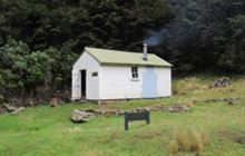
Image: DoC
Scroll down to see a topographical map and road map showing the location of Hidden Hut
[ A ] [ B ] [ C ] [ D ] [ E ] [ F ] [ G ] [ H ] [ I ] [ J ] [ K ] [ L ] [ M ] [ N ] [ O ] [ P ] [ Q ] [ R ] [ S ] [ T ] [ U ] [ V ] [ W ] [ Y ] [ Z ]
Closest 20 Huts to Hidden Hut
These are as the crow fliesTurkeys Nest Bivouac 2.31km Gosling Hut 5.03km Boulder Forks Hut 6.56km Caves Hut 11.48km Blue Mountain Hut 13.87km Top Whare 15.98km Lower Goulter Hut 17.29km Barbers Hut 17.32km Mid Goulter Hut 18.4km Greigs Hut 19.13km Lake Chalice Hut 19.23km Silverstream Bivouac 21.89km Mid Silverstream Hut 22.64km Top Gordon Hut 22.92km Top Wairoa Hut 23.25km Tarn Hut 23.44km Mid Wairoa Hut 23.72km Siberia Hut 24km Old Man Hut 24.01km Bottom Gordons Hut 24.53km Burnt Yards Hut 24.98km Red Hills Hut 25.26km Mt Rintoul Hut 25.3km Lost Stream Bivouac 26.47km Porters Creek Hut 26.57km Bull Paddock Creek Hut 26.9km Bottom Misery Hut 27.94km Slaty Hut 28.31km Hunters Hut 28.89km Top Misery Hut 29.71km Beebys Hut 30.35km Lake Alexander Hut 30.39km Richmond Saddle Hut 30.44km Munroe Hut 31.22km Top Leatham Hut 31.42km Old Middlehurst Hut 31.56km Starveall Hut 31.67km Penk Hut 32.6km Branch Bivouac 32.85km Mt Fell Hut 32.89km