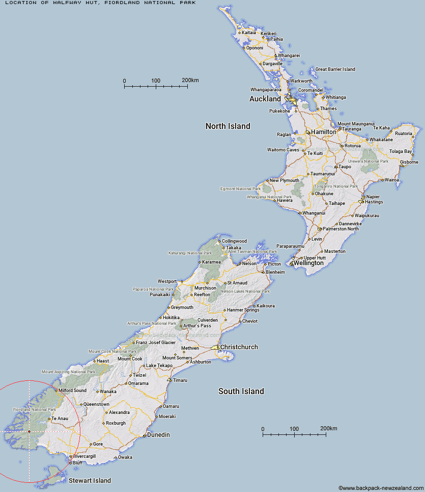
Topo Map showing location of Halfway Hut
This information is sourced from DoC, LINZ and Openstreetmap. Some of the hut photos are mine and the rest are from DoC. I will be adding an upload feature soon so people can photos of .Halfway Hut.
Basic info: standard 12-bunk hut in western Fiordland.
Latitude: -45.7597928598
Longitude: 167.143020327
Location: Fiordland National Park
Area: Fiordland
Type of Hut: Standard
Tracks: Dusky Track
Map: CE06 Topo Map | Road Map
Does this hut still exist? Have any more information? Contact
Basic info: standard 12-bunk hut in western Fiordland.
Latitude: -45.7597928598
Longitude: 167.143020327
Location: Fiordland National Park
Area: Fiordland
Type of Hut: Standard
Tracks: Dusky Track
Map: CE06 Topo Map | Road Map
Does this hut still exist? Have any more information? Contact
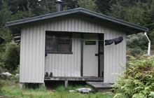
Image: DoC
Scroll down to see a topographical map and road map showing the location of Halfway Hut
[ A ] [ B ] [ C ] [ D ] [ E ] [ F ] [ G ] [ H ] [ I ] [ J ] [ K ] [ L ] [ M ] [ N ] [ O ] [ P ] [ Q ] [ R ] [ S ] [ T ] [ U ] [ V ] [ W ] [ Y ] [ Z ]
Closest 20 Huts to Halfway Hut
These are as the crow fliesLake Roe Hut 6.25km Hauroko Burn Hut 7.88km Loch Maree Hut 10.27km Historic Clark Hut 13.89km Clark Hut - A Frame 15.05km Kintail Hut 16.28km Supper Cove Hut 16.68km Borland Bivouac 17.86km Monowai Hut 18.01km Upper Spey Hut 20.02km Green Lake Hut 20.14km Eel Creek Hut 21.73km Caroline Hut 22.92km Percy Shelter 23.6km Rodger Inlet Huts 25.68km West Arm Hut 27.67km North Borland Hut 27.87km Teal Bay Hut 36.08km Hope Arm Hut 36.26km Back Valley Hut 38.4km Lake Poteriteri Hut 39.04km Freeman Burn Hut 40.05km Okaka Lodge 46.25km Shallow Bay Hut 47.01km Moturau Hut 47.73km Slaughterburn Hut 48.45km Iris Burn Hut 49.22km Cheviot Downs Hut 51.89km Hanging Valley Shelter 51.9km Forest Burn Shelter 53km Redcliff Hut 53.26km Waitutu Hut 53.44km The Gut Hut 53.63km Westies Hut 53.83km Whare Creek Hut 54.02km Port Craig Lodge 54.09km Port Craig School Hut 54.15km Te Oneroa Hut 54.3km Telford Hut 54.54km Percy Burn Hut 55km