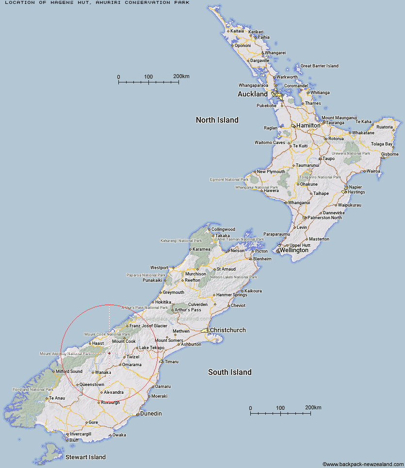
Topo Map showing location of Hagens Hut
This information is sourced from DoC, LINZ and Openstreetmap. Some of the hut photos are mine and the rest are from DoC. I will be adding an upload feature soon so people can photos of .Hagens Hut.
Basic info: standard four-bunk hut in the Mackenzie Country and Waitaki area.
Latitude: -44.1554453041
Longitude: 169.639606362
Location: Ahuriri Conservation Park
Area: Canterbury
Type of Hut: Standard
Tracks: Ahuriri Valley Track
Map: BZ14 Topo Map | Road Map
Does this hut still exist? Have any more information? Contact
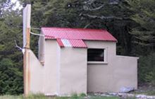
Image: DoC
Scroll down to see a topographical map and road map showing the location of Hagens Hut
[ A ] [ B ] [ C ] [ D ] [ E ] [ F ] [ G ] [ H ] [ I ] [ J ] [ K ] [ L ] [ M ] [ N ] [ O ] [ P ] [ Q ] [ R ] [ S ] [ T ] [ U ] [ V ] [ W ] [ Y ] [ Z ]
Closest 20 Huts to Hagens Hut
These are as the crow fliesHagens Hut 0km Top Hut 4.23km Shamrock Hut 5.89km Bull Flat Hut 8.11km Ferguson Hut 8.16km South Temple Hut 9.23km Scrubby Hut 10.47km Maitland Hut 10.68km Forbes Hut 11.95km Ahuriri Base Hut 13.35km South Huxley Bivouac 14.6km Snowy Gorge Hut 14.92km Top Dingle Hut 15.42km Makarora Hut 16.15km Boundary Hut 16.74km Green Bush Hut 17.46km Little Boundary Hut 17.59km Main Huxley Forks Hut 18.43km Wills Hut 19.25km Brewster Hut 19.64km Monument Hut 20.08km Brodrick Hut 21.29km Hideaway Hut 21.43km Ben Avon Hut 21.92km Red Hut 23.33km High Burn Hut 23.44km Cotters Hut 24.95km Creswicke Flat Hut 26.14km Cameron Hut 26.27km Le Crens Hut 27.52km Dasler Bivouac 27.61km Elcho Hut 29.21km Big Hopwood Burn Hut 30km Cullers Hut 30.35km Bush Hut 31.52km Stony Stream Bivouac 32.38km Station Hut 32.91km Baikie Hut 34.34km Dodger Hut 34.62km Grough Hut 34.82km