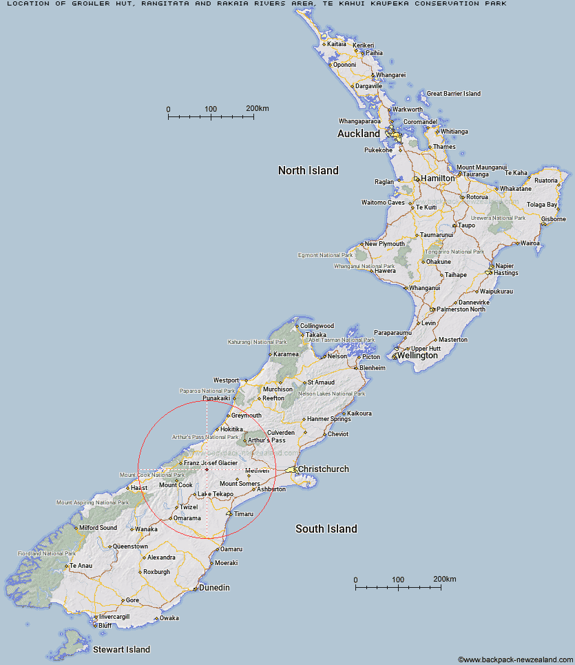
Topo Map showing location of Growler Hut
This information is sourced from DoC, LINZ and Openstreetmap. Some of the hut photos are mine and the rest are from DoC. I will be adding an upload feature soon so people can photos of .Growler Hut.
Basic info: Growler Hut is a standard hut in the Mid and South Canterbury area.
Latitude: -43.5109110205
Longitude: 170.738764854
Location: Rangitata and Rakaia Rivers area, Te Kahui Kaupeka Conservation Park
Area: Canterbury
Type of Hut: Standard
Map: BX17 Topo Map | Road Map
Does this hut still exist? Have any more information? Contact
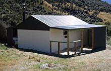
Image: DoC
Scroll down to see a topographical map and road map showing the location of Growler Hut
[ A ] [ B ] [ C ] [ D ] [ E ] [ F ] [ G ] [ H ] [ I ] [ J ] [ K ] [ L ] [ M ] [ N ] [ O ] [ P ] [ Q ] [ R ] [ S ] [ T ] [ U ] [ V ] [ W ] [ Y ] [ Z ]
Closest 20 Huts to Growler Hut
These are as the crow fliesCarneys Bivvy's 6.37km Curtis Memorial Hut 6.85km Murphys Bivvy 6.9km Black Mountain Hut 7.4km Mistake Flats Hut 7.85km Forbes Bivouac 8.93km Dog Kennel Bivouac 9.95km Erewhon Station Hut 11.34km Saint Winifreds Hut 11.36km Watchdog Hut 12.1km Crooked Spur Hut 13.21km Macaulay Hut 13.37km McCoy Hut 15.04km Lawrence Hut 15.45km Hermitage Hut 18.29km Godley Hut 18.73km Potts Hut 18.84km Red Stag Hut 19.33km Stone Hut 19.68km Stony Stream Hut 20.04km Scone Hut 20.33km Eade Memorial Hut 20.73km Lawrence Bivouac 23.15km Rankin Hut 23.51km Royal Hut 23.91km Felt Hut 25.06km Top Hut 25.47km Top Butler Hut 26.1km Angus Hut 26.6km Boundary Creek Hut 26.9km Lyell Hut 27.3km Nolans Hut 27.5km Cameron Hut 27.64km Murchison Hut 27.79km Butler Junction Hut 28.59km Ribbonwood Hut 28.61km Highland Home 28.98km Rex Simpson Hut 29.9km Kelman Hut 30.48km Whymper Hut 30.6km