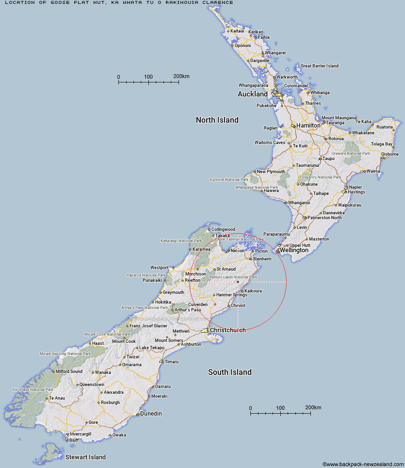
Topo Map showing location of Goose Flat Hut
This information is sourced from DoC, LINZ and Openstreetmap. Some of the hut photos are mine and the rest are from DoC. I will be adding an upload feature soon so people can photos of .Goose Flat Hut.
Basic info: standard 10-bunk hut in the South Marlborough area.
Latitude: -42.1511618905
Longitude: 173.550988114
Location: Ka Whata Tu o Rakihouia Clarence
Area: Marlborough
Type of Hut: Standard
Map: BT27 Topo Map | Road Map
Does this hut still exist? Have any more information? Contact
Basic info: standard 10-bunk hut in the South Marlborough area.
Latitude: -42.1511618905
Longitude: 173.550988114
Location: Ka Whata Tu o Rakihouia Clarence
Area: Marlborough
Type of Hut: Standard
Map: BT27 Topo Map | Road Map
Does this hut still exist? Have any more information? Contact
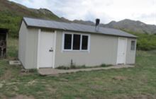
Image: DoC
Scroll down to see a topographical map and road map showing the location of Goose Flat Hut
[ A ] [ B ] [ C ] [ D ] [ E ] [ F ] [ G ] [ H ] [ I ] [ J ] [ K ] [ L ] [ M ] [ N ] [ O ] [ P ] [ Q ] [ R ] [ S ] [ T ] [ U ] [ V ] [ W ] [ Y ] [ Z ]
Closest 20 Huts to Goose Flat Hut
These are as the crow fliesFidgit Bivouac 7.1km Dubious Bivouac 7.38km Limestone Hut 10.85km Ravine Hut 11.35km Haycocks Bivouac 12.71km Barratts Bivouac 14.32km Barratts Hut 14.39km Seymour Hut 14.82km Jam Hut 14.89km Hapuku Hut 15.83km Kowhai Hut 16.77km Warden Hut 16.93km Black Spur Historic Hut 17.28km Tent Poles Hut 18.11km Hornby Bivvy 18.69km Snowgrass Hut 19.05km Mt Fyffe Hut 19.54km Lake McRae Hut 19.98km Old Middlehurst Hut 20.55km Kahutara Bivouac 22.38km Dee Hut 23.5km Alfred Hut 25.51km Gibson Hut 26.87km Palmer Hut 28.49km Munroe Hut 28.76km Mead Hut 29.04km Burnt Yards Hut 29.34km Cam Hut 29.68km Cabbage Tree Hut 30.13km Carters Yards Hut 30.97km Junction Hut 31.42km Palmer Bivouac 31.82km Flynns 33.85km Stone Jug Hut 34.28km Saxton Hut 34.57km Team Hut 34.72km Top Whare 35.62km Swale Hut 35.78km Acheron Hut 35.91km Beechs Hut 36.63km