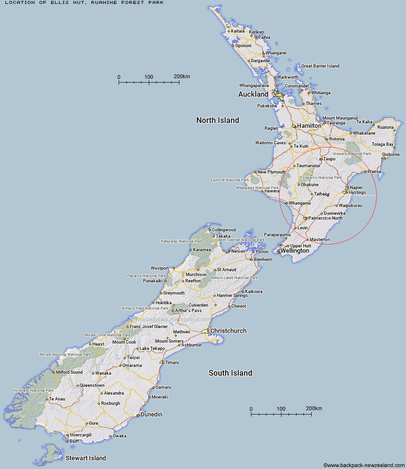
Topo Map showing location of Ellis Hut
This information is sourced from DoC, LINZ and Openstreetmap. Some of the hut photos are mine and the rest are from DoC. I will be adding an upload feature soon so people can photos of .Ellis Hut.
Basic info: This is an historic hut, used for farming, wild animal control and recreation purposes since it was built in 1884.
Latitude: -39.7139215341
Longitude: 176.281589873
Location: Ruahine Forest Park
Area: Hawke's Bay
Type of Hut: Basic/bivvies
Map: BK37 Topo Map | Road Map
Does this hut still exist? Have any more information? Contact
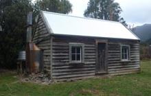
Image: DoC
Scroll down to see a topographical map and road map showing the location of Ellis Hut
[ A ] [ B ] [ C ] [ D ] [ E ] [ F ] [ G ] [ H ] [ I ] [ J ] [ K ] [ L ] [ M ] [ N ] [ O ] [ P ] [ Q ] [ R ] [ S ] [ T ] [ U ] [ V ] [ W ] [ Y ] [ Z ]
Closest 20 Huts to Ellis Hut
These are as the crow fliesPoutaki Hut 3.22km Tin Hut 4.31km Parks Peak Hut 4.84km Sentry Box Hut 5.03km Upper Makaroro Hut 5.9km Barlow Hut 5.94km Norris Hut 7.12km Briens Hut 7.34km Kylie Bivouac 7.98km Gold Creek Hut 8.97km Sparrowhawk Bivouac 9.15km Aranga Hut 9.17km Masters Shelter 10.08km Triplex Hut 11.36km Mistake Bivouac 11.9km Rockslide Hut 11.98km Maropea Forks Hut 12.36km Top Maropea Hut 12.52km Sunrise Hut 12.69km Colenso Hut 12.94km Waipawa Forks Hut 13.1km Ruahine Corner Hut 13.14km Wakelings Hut 13.75km Herricks Hut 14.64km No Mans Hut 14.74km Dead Dog Hut 15.16km Ikawetea Forks Hut 15.53km Iron Bark Hut 16.56km Waikamaka Hut 16.66km Otukota Hut 16.76km McKinnon Hut 17.66km Smiths Stream Hut 17.79km Crow Hut 17.8km Ruahine Hut 17.84km Makirikiri Hut 18.17km Hinerua Hut 19.02km Dianes Hut 19.08km Waterfall Hut 19.2km Taruarau Bivouac 19.2km Kawhatau Base 21.06km